When it comes to Airborne LiDAR surveys, timing is everything. Whether you need data for seasonal analysis, regulatory reporting, or operational planning, Aerometrex ensures that high-resolution LiDAR mapping occurs under optimal conditions while adhering to strict timelines. Our approach balances industry standards linked to environmental conditions and client-specific deadlines to deliver high-quality, accurate data when matters most.
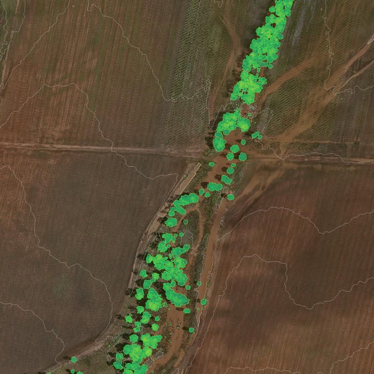
<< Image: Tree Canopy Coverage (green) and Contours (white), Douglas Daily Region, Northern Territory
Problem: Environmental conditions can delay data acquisition.
Solution: Aerometrex ensures timely data capture by proactively scheduling flights under optimal conditions, following ICSM (Intergovernmental Committee on Surveying and Mapping) standards.
--
Aerometrex conducts every Airborne LiDAR survey in line with well-established industry standards, such as the ‘Australian Airborne LiDAR Acquisition Specifications’ by the ICSM. These guidelines define optimal capture conditions, including:
While these environmental factors guide our operations, many projects also require data capture on a fixed date and rapid delivery to align with internal reporting cycles. Aerometrex works closely with clients to accommodate these specific needs, ensuring timely data acquisition and delivery without compromising accuracy.
Problem: Seasonal vegetation can obscure ground data.
Solution: Aerometrex schedules LiDAR surveys at the ideal time to capture clear, accurate ground and vegetation data.
--
One of the key advantages of Airborne LiDAR is its ability to penetrate vegetation, providing both ground surface elevation data and detailed vegetation metrics. Many industries rely on precise seasonal timing to ensure the captured data aligns with specific operational goals such as vegetation management and accurate commercial forecasting.
Aerometrex strategically plans LiDAR surveys to account for these seasonal factors, ensuring datasets are fit for purpose. With careful scheduling, Aerometrex ensures that LiDAR data is captured at the right moment to provide the most valuable insights for your industry.
Outlined below are some examples where Aerometrex has planned and executed timely surveys, navigating seasonal changes in the landscape, to ensure that the data is fit for purpose.
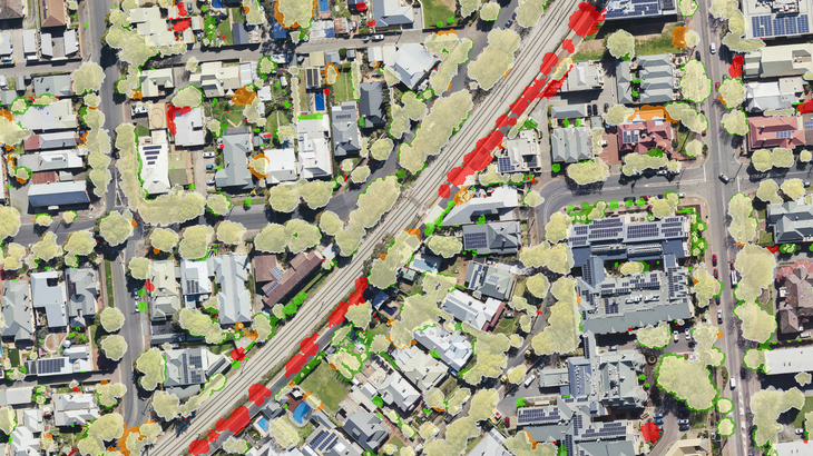
<< Image: Classified tree canopy change detection, City of Unley, Adelaide
Urban Forestry Management: Consistent LiDAR timing allows for detailed canopy change detection, supporting long-term urban forest management. Read More: Unley Case Study
River Catchment Erosion Monitoring: Capturing data when vegetation cover is minimal enhances the visibility of fine-scale erosional features, improving risk modelling accuracy. Read More: Great Barrier Reef Case Study
Precision Agriculture: Surveying between cropping cycles ensures accurate ground elevation measurements, critical for farm management and planning. Read More: NT Farmers Case Study
Commercial Forestry: LiDAR is used to map forestry estates at specific growth stages, providing critical metrics for growth rates, tree health, and commercial forecasting. Read More: HQPlantations Case Study
Problem: Traditional survey methods cause delays and disrupt operations.
Solution: Aerometrex delivers high-quality LiDAR data in as little as 24 hours, minimising downtime and supporting rapid decision-making.
--
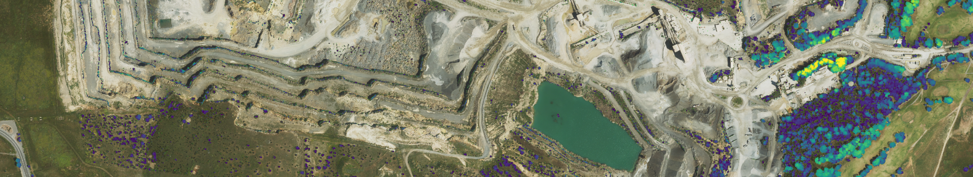
For many industries, especially mining, internal reporting and operational planning require LiDAR data to be captured on a specific date and delivered as quickly as possible. This ensures that the LiDAR data and derived products are a snapshot of the project area at a specific point in time relevant to reporting requirements. Aerometrex specialises in time-sensitive LiDAR data acquisition and delivery, ensuring clients receive high-quality datasets precisely when they need them.
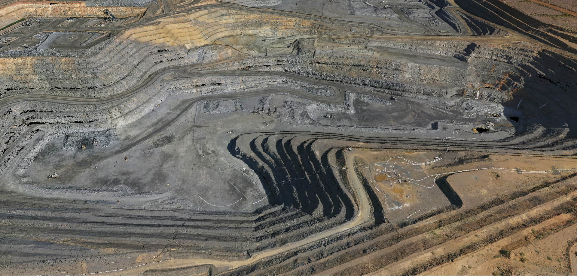
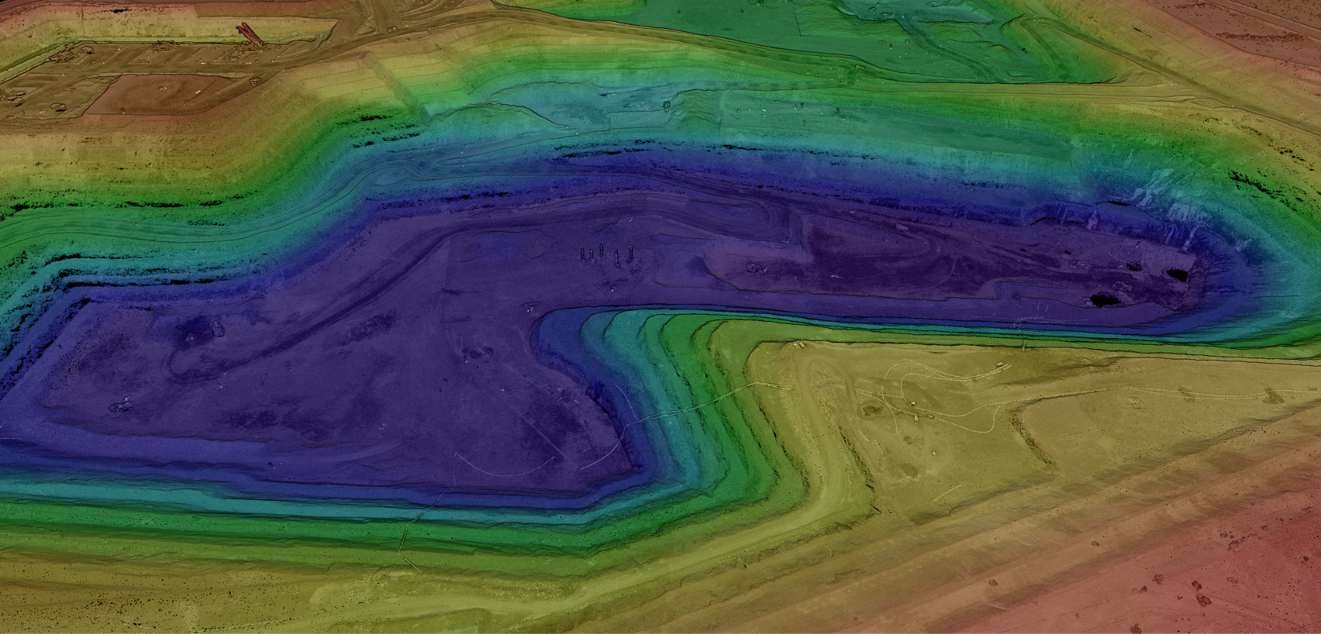
Why Fixed-Date LiDAR Matters in Mining
The mining industry relies on LiDAR to capture site-wide elevation datasets, eliminating the need for traditional field-based surveys. This not only enhances operational efficiency but also reduces safety risks associated with on-site data collection.
Key Applications for Mining Clients:
To meet mining clients' strict reporting deadlines, Aerometrex employs advanced planning workflows and an experienced Flight Operations team. Our team monitors weather conditions in real-time to schedule surveys as close as possible to the required date, maintaining project timing, specifications and adherence to applicable standards. Once captured, our streamlined processing workflows allow us to deliver fully quality-assured datasets in as little as 24 hours, enabling rapid decision-making and operational efficiencies.
At Aerometrex, we understand that timing is crucial. Whether your project requires seasonal data collection or fixed-date acquisition with rapid delivery, our expert team ensures your LiDAR data is captured and delivered on schedule - without compromising quality.
Need LiDAR data to meet strict operational deadlines?
Contact Aerometrex for expert LiDAR data acquisition solutions and to discuss how we can tailor our services to your specific requirements.
CONTACT OUR TEAM