Our team has developed multiple LiDAR-derived data processes to measure and track changes in tree canopies across the urban landscape. These new capabilities have been demonstrated in a recent collaborative project with the City of Unley in South Australia.
The tree canopy coverage data we output gives the City of Unley a guide to precisely where and by how much tree canopy coverage is changing, and how those changes are distributed across different land ownership types. Aerometrex has also developed new insights into how established and newly planted trees affect total canopy coverage, and how land ownership distribution affects the viability of tree canopy management strategies.
Increasing urban greenness, vegetation and urban tree canopy cover has become one of the most critical considerations for strategic planning within all levels of government. The City of Unley now understands the tree canopy area, coverage, and change. As a result, they have the data to communicate more accurately and effectively with the community on tree management.
Aerometrex measured an increase in tree canopy coverage from 26.63% to 27.99% across the City of Unley’s local government area between 2018 and 2021.
Aerometrex generated that Canopy Coverage data from repeated council-wide LiDAR-capture and LiDAR data-derived assessments of the City of Unley in 2018 and 2021. The 2021 data capture was within two calendar weeks of the 2018 capture to minimise seasonal foliage variations.
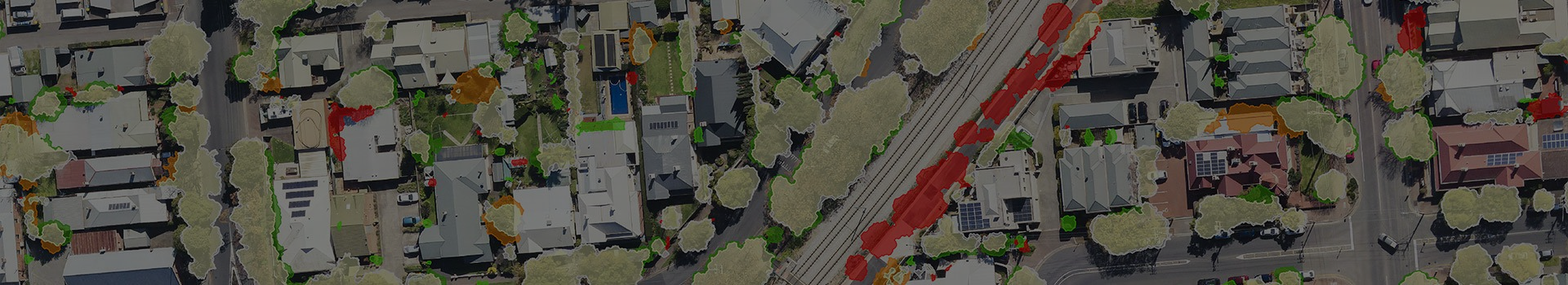
Aerometrex applied newly developed Object Based Imagery Analysis (OBIA) to the high-resolution LiDAR point cloud and derived raster datasets to generate more specific change statistics. A rule-based classification separated tree canopy change between the 2018 and 2021 datasets into Tree Growth, Tree Planting, Tree Removal, and Pruning Removal. Aerometrex used their MetroMap high-resolution aerial imagery to validate the canopy change classification.
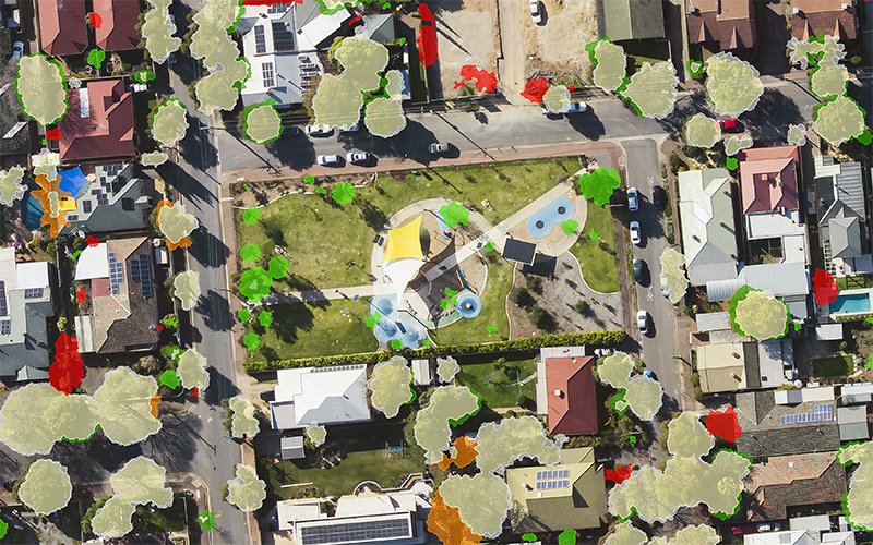
Katherine Street Park was re-claimed as green space by the City of Unley and shows new canopy growth
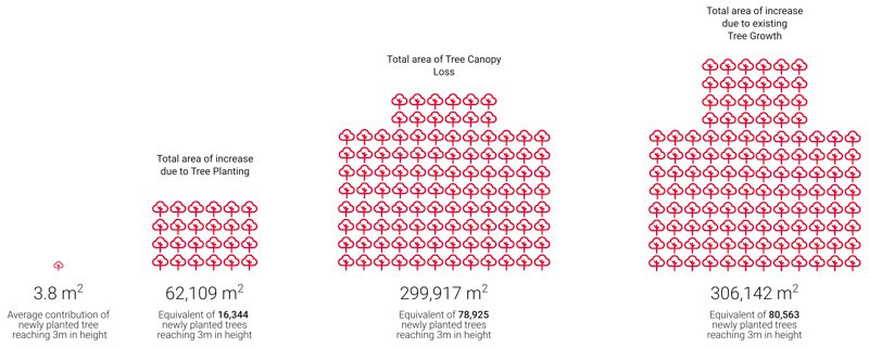
Aerometrex’s data found growth of existing trees contributed five times as much new tree canopy cover as newly planted trees that have reached a height of 3m, and give thermal and shading benefit, between 2018 and 2021. Total canopy coverage losses from tree removal and pruning are the equivalent of approximately 78,900 newly planted trees (299,917 m2). Newly planted trees only contribute 3.8m2 of canopy coverage on average.
Councils can now use true equivalence between established tree canopy and newly planted tree canopy when planning and executing urban tree management. Private landowners can also assess the true impacts of tree removal and be encouraged to preserve existing trees rather than rely on new planting.
Councils who know where tree canopy cover changes can better communicate, plan, and engage with the local community. The division of private and public land within the City of Unley means cooperation will be needed to meet tree canopy and urban greening targets.
Aerometrex’s tree canopy coverage data shows critical land ownership data for the City of Unley. While residents rely on the City Council to lead tree conservation activities, the Aerometrex data showed that canopy loss on private land was 4.6 times greater than council-controlled land. The largest, most significant losses of tree canopy is intrinsically linked to urban development.
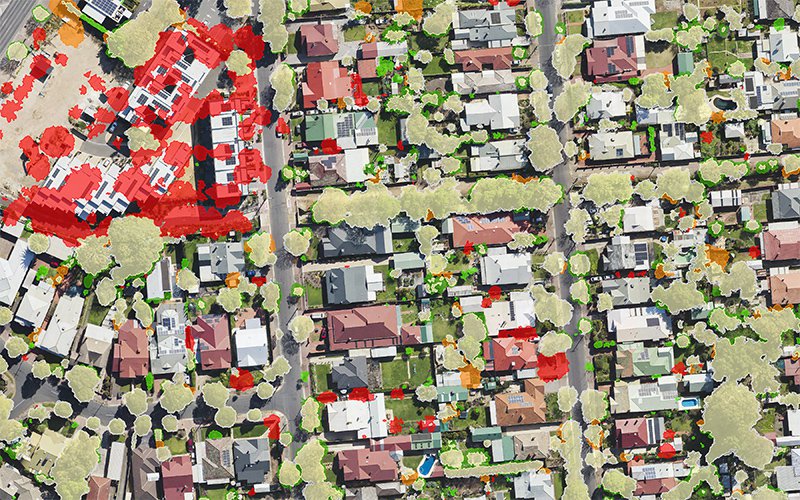
New developments [top-left] of frame show canopy lost to urban infill
Aerometrex’s canopy cover data gives councils better measurement, and more comprehensive data to plan, execute, and communicate their urban tree management strategies. This project with the City of Unley shows the importance of quantifiable canopy coverage data. All stakeholders within the City of Unley have the data to make better-informed and more effective decisions when managing trees.