Our History, Our Promise…
Since its establishment in 1980, Aerometrex has built a strong national and international reputation as a leading practitioner of aerial imaging, photogrammetry, 3D modelling and LiDAR surveys.
We have always been at the forefront of spatial technology advances and pride ourselves on our exemplary customer service and delivering the very best product in the market. This ethos has grown our business over time, with high levels of customer satisfaction.
Aerometrex products are renowned worldwide for very high standards of production quality and accuracy and our range of solutions is second to none. Whether you are a government planner, a property developer, an engineer, a solar installer, an environmental scientist, a mine manager or a lawyer, you can trust our products.
A long operating history with a highly experienced workforce is a key strength of Aerometrex. Considerable ‘know-how’ and intellectual property has been accumulated by the company and is in daily use by its 100+ staff members.
Our people are our strongest asset and the assemblage of skills and experience is seen across a range of functions including aviation, aerial surveying, flight planning, photogrammetry, 3D modelling, LiDAR processing, sales and marketing, R&D, etc.
Interested in working at Aerometrex?
Find out more
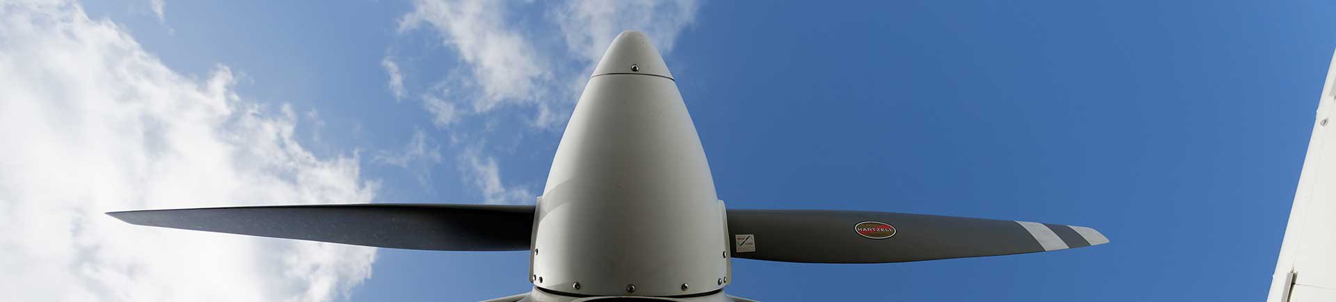
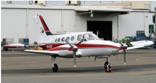
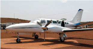
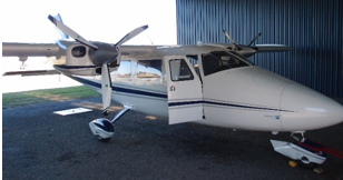
Aerometrex has established its own aviation operations buying its first aircraft in 2014 and currently operating a nine-aircraft fleet. Additional aircraft are hired based on requirements from time to time. These aircraft provide Aerometrex with the capability to offer digital aerial photography ranging from 3.5cm to 50cm pixel resolutions.
Aircrafts owned by Aerometrex include:
Aerometrex designed aerial camera system
Aerometrex owns its own in-house designed & developed camera system known as MetroCam. It is designed to offer greater efficiency & quality, promising multi-fold benefits in the form of increased resolution, unmatched colour quality, larger area coverages, and more frequent captures. This camera system enables Aerometrex to control a much greater degree of the supply and maintenance costs of these sophisticated aerial camera systems, as well as representing a significant technological advance.
Other aerial camera systems
Aerometrex also uses Vexcel Imaging’s Ultracam large-format aerial mapping cameras as well as Visionmap’s A3 Edge very large-format digital camera. All provide reliable high-quality imagery with efficiency and accuracy. The Ultracam large format digital aerial cameras are set up with the SOMAG3000 gyro-stabilised mount and IGI Inertial Motion Unit (IMU) to capture exceptional quality, near-vertical, 4-band imagery. We also have an outstanding oblique imagery capability using the MIDAS-5 camera as well as a range of medium-format and DSLR camera systems.
Other Equipment and Data Processing Software
Aerometrex operates three Riegl VQ-780i for ultra-wide area mapping and high productivity coupled with a 100MP digital camera as well as one Trimble Harrier H68i coupled with an 80MP digital camera.
Aerometrex uses the high-end photogrammetric software suite INPHO from Germany and Lightspeed from Visionmap for image data processing.
Client Base
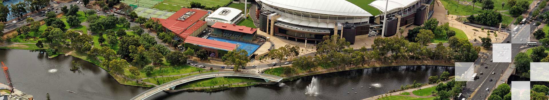
Aerometrex is a valued participant of every State and Federal Government Panel of Aerial Imagery Providers, and routinely performs major Government contracts to a very high standard. The company’s services are also in heavy demand by many private sector industries with projects executed & delivered across Australia, New Zealand, USA, Europe, Africa, the Middle East and South East Asia.
Experience
Aerometrex has conducted major aerial imagery programs in Australia for Microsoft, with its Bing Maps Ultracam Osprey oblique camera program for every Australian capital city, and for Google Earth, with its Australia/NZ Cities 3D mapping program. Some of the largest aerial surveys undertaken in Australia have been acquired and processed by Aerometrex. These include the Galilee Basin survey of 115,000 sq. km. for the Queensland Government, the Western Victoria aerial survey of 73,500 sq. km. for the Victorian Government, and a series of cross-continental linear corridor surveys of 9,000 km for Visionstream Pty Ltd.
2023 South Australia Spatial Excellence Award (GCA)
International Partnership: Las Vegas High-Resolution 3D Reality Mesh Model Project
2023 Northern Territory Spatial Excellence Award (GCA)
Geospatial Enablement: Advancing Holistic Agricultural Practices and Land Stewardship through LiDAR Innovation (Aerometrex and NT Farmers)
2024 SA/NT iAwards - Merit Award (AIIA)
Sustainability & Environmental: MetroMap Insights
2024 Awards for Planning Excellence (Planning Institute of Australia)
Technology & Digital Innovation: Land iQ (Standardised land use evaluation tool) awarded to Property and Development NSW, in collaboration with WSP Australia, Giraffe Technology and Aerometrex.
Bentley ‘Be Inspired’ Award
2016: Reality Modelling for the Papal Visit to Philadelphia
Asia-Pacific Spatial Excellence Award
2013: Innovation and Commercialisation: aero3Dpro – a 3D modelling service
South Australia Spatial Excellence Awards
2021: Environment and Sustainability: Very high-resolution LIDAR-derived tree canopy change detection to explore financial measures to improve tree canopy cover on private land. (Aerometrex and City of Unley)
2021: Technical Excellence: LIDAR and Deep Learning-derived Permeable and Impermeable Ground Surface Classification
2017: Innovation and Commercialisation: MetroMap (Aerometrex and Jacobs)
2016: Environment and Sustainability: Onkaparinga Cliffs 3D model
2016: Spatial Enablement: 3D Modelling for the Papal Visit to Philadelphia
2013: Innovation and Commercialisation: aero3Dpro - a 3D modelling service
2009: Infrastructure and Construction: NEXY Project
2008: Innovation and Commercialisation: Metro Adelaide
NSW Spatial Excellence Award
2016: Innovation and Commercialisation: MetroMap (Aerometrex and Jacobs)
Victoria Spatial Excellence Award
2021: Award for Innovation: Greening Melbourne - New and innovative 3D spatial technology to help deliver a greener, more sustainable and climate-resilient city
Northern Territory Spatial Excellence Awards
2012: Infrastructure and Construction: The National Broadband Network Aerial Survey
Queensland Spatial Excellence Award
2017: People and Community: Springwood – the start of South East Queensland’s next CBD (Aerometrex and Logan City Council)
Western Australia Spatial Excellence Awards
2015: Innovation and Commercialisation: aero3Dpro–Earthmine Integrated Solution (Aerometrex and Landgate)
2015: Environment and Sustainability: Using high-resolution aerial imagery to search for Malleefowl Mounds (Aerometrex, Terrestrial Ecosystems and Mt Gibson Mining)
A long operating history with a highly experienced workforce is a key strength of Aerometrex. Considerable ‘know-how’ and intellectual property has been accumulated by the company and is in daily use by its 100+ staff members.
Our people are our strongest asset and the assemblage of skills and experience is seen across a range of functions including aviation, aerial surveying, flight planning, photogrammetry, 3D modelling, LiDAR processing, sales and marketing, R&D, etc.
Interested in working at Aerometrex?
Find out more
Aerometrex has established its own aviation operations buying its first aircraft in 2014 and currently operating a nine-aircraft fleet. Additional aircraft are hired based on requirements from time to time. These aircraft provide Aerometrex with the capability to offer digital aerial photography ranging from 3.5cm to 50cm pixel resolutions.
Aircrafts owned by Aerometrex include:
Aerometrex designed aerial camera system
Aerometrex owns its own in-house designed & developed camera system known as MetroCam. It is designed to offer greater efficiency & quality, promising multi-fold benefits in the form of increased resolution, unmatched colour quality, larger area coverages, and more frequent captures. This camera system enables Aerometrex to control a much greater degree of the supply and maintenance costs of these sophisticated aerial camera systems, as well as representing a significant technological advance.
Other aerial camera systems
Aerometrex also uses Vexcel Imaging’s Ultracam large-format aerial mapping cameras as well as Visionmap’s A3 Edge very large-format digital camera. All provide reliable high-quality imagery with efficiency and accuracy. The Ultracam large format digital aerial cameras are set up with the SOMAG3000 gyro-stabilised mount and IGI Inertial Motion Unit (IMU) to capture exceptional quality, near-vertical, 4-band imagery. We also have an outstanding oblique imagery capability using the MIDAS-5 camera as well as a range of medium-format and DSLR camera systems.
Other Equipment and Data Processing Software
Aerometrex operates three Riegl VQ-780i for ultra-wide area mapping and high productivity coupled with a 100MP digital camera as well as one Trimble Harrier H68i coupled with an 80MP digital camera.
Aerometrex uses the high-end photogrammetric software suite INPHO from Germany and Lightspeed from Visionmap for image data processing.
Client Base
Aerometrex is a valued participant of every State and Federal Government Panel of Aerial Imagery Providers, and routinely performs major Government contracts to a very high standard. The company’s services are also in heavy demand by many private sector industries with projects executed & delivered across Australia, New Zealand, USA, Europe, Africa, the Middle East and South East Asia.
Experience
Aerometrex has conducted major aerial imagery programs in Australia for Microsoft, with its Bing Maps Ultracam Osprey oblique camera program for every Australian capital city, and for Google Earth, with its Australia/NZ Cities 3D mapping program. Some of the largest aerial surveys undertaken in Australia have been acquired and processed by Aerometrex. These include the Galilee Basin survey of 115,000 sq. km. for the Queensland Government, the Western Victoria aerial survey of 73,500 sq. km. for the Victorian Government, and a series of cross-continental linear corridor surveys of 9,000 km for Visionstream Pty Ltd.
2023 South Australia Spatial Excellence Award (GCA)
International Partnership: Las Vegas High-Resolution 3D Reality Mesh Model Project
2023 Northern Territory Spatial Excellence Award (GCA)
Geospatial Enablement: Advancing Holistic Agricultural Practices and Land Stewardship through LiDAR Innovation (Aerometrex and NT Farmers)
2024 SA/NT iAwards - Merit Award (AIIA)
Sustainability & Environmental: MetroMap Insights
2024 Awards for Planning Excellence (Planning Institute of Australia)
Technology & Digital Innovation: Land iQ (Standardised land use evaluation tool) awarded to Property and Development NSW, in collaboration with WSP Australia, Giraffe Technology and Aerometrex.
Bentley ‘Be Inspired’ Award
2016: Reality Modelling for the Papal Visit to Philadelphia
Asia-Pacific Spatial Excellence Award
2013: Innovation and Commercialisation: aero3Dpro – a 3D modelling service
South Australia Spatial Excellence Awards
2021: Environment and Sustainability: Very high-resolution LIDAR-derived tree canopy change detection to explore financial measures to improve tree canopy cover on private land. (Aerometrex and City of Unley)
2021: Technical Excellence: LIDAR and Deep Learning-derived Permeable and Impermeable Ground Surface Classification
2017: Innovation and Commercialisation: MetroMap (Aerometrex and Jacobs)
2016: Environment and Sustainability: Onkaparinga Cliffs 3D model
2016: Spatial Enablement: 3D Modelling for the Papal Visit to Philadelphia
2013: Innovation and Commercialisation: aero3Dpro - a 3D modelling service
2009: Infrastructure and Construction: NEXY Project
2008: Innovation and Commercialisation: Metro Adelaide
NSW Spatial Excellence Award
2016: Innovation and Commercialisation: MetroMap (Aerometrex and Jacobs)
Victoria Spatial Excellence Award
2021: Award for Innovation: Greening Melbourne - New and innovative 3D spatial technology to help deliver a greener, more sustainable and climate-resilient city
Northern Territory Spatial Excellence Awards
2012: Infrastructure and Construction: The National Broadband Network Aerial Survey
Queensland Spatial Excellence Award
2017: People and Community: Springwood – the start of South East Queensland’s next CBD (Aerometrex and Logan City Council)
Western Australia Spatial Excellence Awards
2015: Innovation and Commercialisation: aero3Dpro–Earthmine Integrated Solution (Aerometrex and Landgate)
2015: Environment and Sustainability: Using high-resolution aerial imagery to search for Malleefowl Mounds (Aerometrex, Terrestrial Ecosystems and Mt Gibson Mining)
Aerometrex is a proven leader and innovator within aerial surveying with a long list of industry-defining moments to its name: