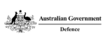
Rio Tinto is utilising the data from Aerometrex to help monitor our closure progress and rehabilitation success at Argyle. Using high-resolution remote sensing data allows us to effectively monitor large areas with high accuracy, reducing the field time required for on-the-ground surveys and the safety risk to the personnel. The data is also extremely helpful in communicating how we are performing and is being used to create graphical representations and 3D models to inform stakeholders
Samantha Sturgess | Principal Advisor Environment, Rio Tinto
MetroMap imagery is a valuable element of the project (Land iQ) helping users identify suitable sites based on defined and configurable criteria such as lot size, land zone and government property registers giving greater context to the overall landscape.
James Strutt | Director of Strategy, Department of Planning and Environment, NSW
We have engaged Aerometrex to conduct a series of high-density airborne LiDAR and imagery campaigns in recent years. This data has now become instrumental in the monitoring of changes to growing stock across our plantation estate. The data has also become increasingly important for the planning of forest operations as the business transitions to precision forestry.
Mark Jones | General Manager Resources, HQPlantations
In 2019, the NSW Department of Planning, Industry and Environment prepared a Master Plan for the Parkes, Wagga Wagga Special Activation Precincts (SAPs) and the Go Jindabyne Master Plan. Aerometrex were the contractor selected to provide spatial data: 3D capture/LiDAR, photogrammetry, and 3D modelling for all three projects plus Snowy Mountains and Moree SAPs in 2020. The work produced by Aerometrex for the three completed projects as well as the two 2020 projects has supported technical studies and public consultation conducted as part of the planning process, to assist the NSW Government in job creation and economic development in designated areas of regional NSW through infrastructure investment and fast-tracked, streamlined planning. Aerometrex worked with the Department suggesting methodologies to make the final products fit for purpose. The work has been first class, economic and delivered in a timely manner.
Rukshan de Silva | Principal Planner, Department of Planning, Industry and Environment NSW
I can always rely on Aerometrex for all my custom aerial photography needs - 2D, 3D, and 4 band. From advice to getting the job done – I am always glad to work with them and use them with my clients – especially Julia from NSW. It’s really great working with them, especially when scoping a project to keep costs down, keep quality of product up and investigate spatial innovations. They make my job as a manager of a GIS team stress free when it comes to imagery. Though the products they deliver are highly technical – Aerometrex makes it simple, easy and at an affordable price. And no area is off limits, even regional Australia! Thanks!
Nikolaas Kostraby | Spatial, Data & Digital Professional
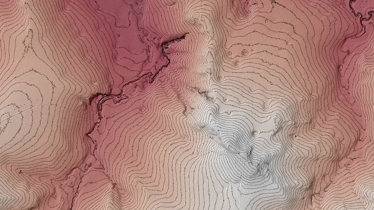
JLL have been an Aerometrex client for at least 4 years utilising the 3D Modelling and MetroMap Services. JLL has created an interactive, virtual-reality model of the future Sydney skyline using information from its own research, 3D data and imagery provided by Aerometrex and cycle-network data from the City of Sydney – to cover the next five years. The model, called “CityViewer”, was built in conjunction with Inspace XR and reveals the full extent of the city’s future development pipeline, giving users a bird’s eye view of the city’s network of future buildings and infrastructure projects. When users don a pair of VR goggles they step into a virtual replica of the Sydney CBD which they can then interact with using a handheld remote-control. The technology is a preview for how JLL envisions virtual reality will become a part of the leasing process. One example of how the technology can help smooth the leasing process for agents and prospective tenants is its ability to categorise buildings according to their environmental credentials. Users can choose to highlight Green Star-performance-rated buildings. They can also see where planned transport networks will improve connectivity.
Travis Brousseau | Senior GIS, JLL
Aerometrex 3D Modelling has allowed the City of Karratha to capture, in 3D, rapid changes in the City Centre via state government investment and allowed the city to give an impression of how the City Centre will look with planned new developments. The City has used this 3D modelling to promote the City Centre and attract funding to key City Centre projects
Jerom Hurley | Manager Planning Services, City of Karratha
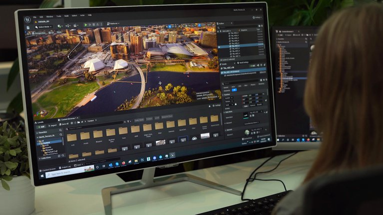
Aerometrex's LiDAR data is particularly useful for assisting in feasibility and high level concept design for infrastructure projects. There are significant areas of regional Australia where the accuracy of pre-existing topographic mapping is not suitable for supporting business case decisions. LiDAR data is often of sufficient accuracy to support some design applications. LiDAR base data sets are also commonly supplemented with ground based data sets to support more detailed localised design.
Peter Murphy | Director / Survey Discipline Manager, Brazier Motti
Mapping of our landscape is the necessary foundational tool required to drive resilient landscape management. It is an essential component that will support responsible and efficient farming ecosystems across the Northern Territory.
SImone Cameron | LiDAR Champion, NT Farmers