Insurance and financial services organisations rely on accurate spatial data to understand risk, assess assets and support informed decision-making. Aerometrex delivers high-quality aerial imagery, LiDAR and 3D modelling that help insurers, reinsurers, banks and asset-focused financial institutions build a clearer picture of property risk and exposure.
Rather than focusing solely on event response, our solutions support pre-event assessment, portfolio analysis and long-term risk understanding, enabling organisations to strengthen underwriting decisions, pricing models and asset evaluations.
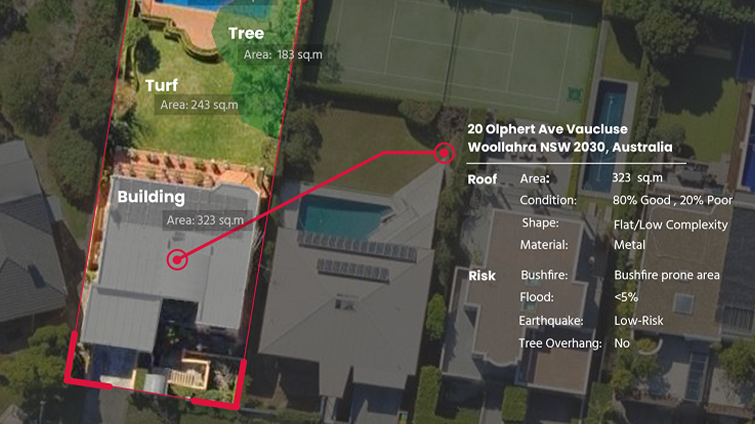
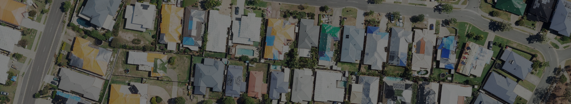
High-resolution aerial imagery provides essential visual context for understanding property characteristics, the surrounding environment and exposure to risk. MetroMap delivers premium aerial imagery captured consistently across Australia, enhanced with AI-driven Insights that help teams move from visual review to scalable analysis.
Used for underwriting and portfolio assessment, MetroMap imagery and Insights support validation of property attributes, identification of risk indicators and consistent assessment across large asset portfolios. Delivered via web access and APIs, imagery and Insights integrate seamlessly into existing GIS, analytics and insurance platforms.
Using aerial imagery and Insights, your team can:
MetroMap provides a reliable imagery and Insights foundation that complements other datasets used across insurance and financial services.
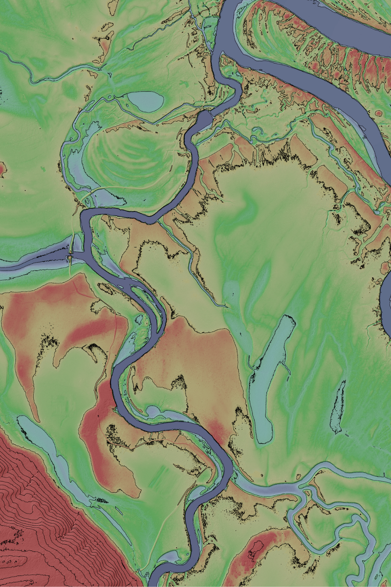
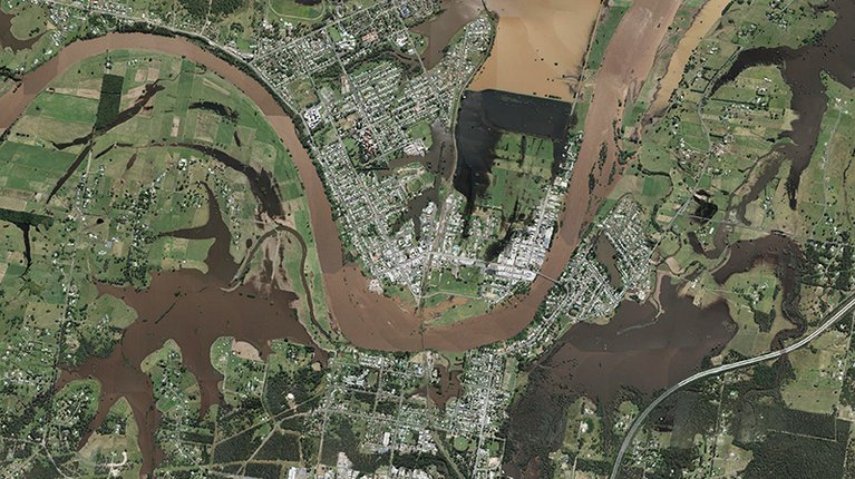
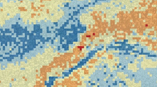
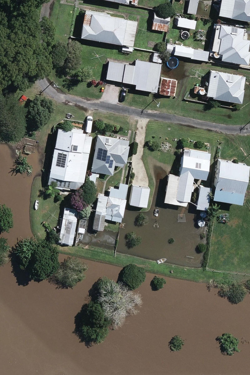
LiDAR delivers precise elevation and surface data that supports advanced risk modelling and exposure analysis. Aerometrex provides aerial LiDAR surveys and derived datasets that are particularly valuable for understanding terrain-driven risk factors such as flooding, drainage, slope and coastal exposure.
For insurers and financial institutions, LiDAR enables a more informed assessment of risk at both the individual property and portfolio level.
LiDAR data provides your team with:
LiDAR-derived products such as DTMs, DSMs and contours integrate directly with modelling and analytics environments, supporting more robust risk frameworks.
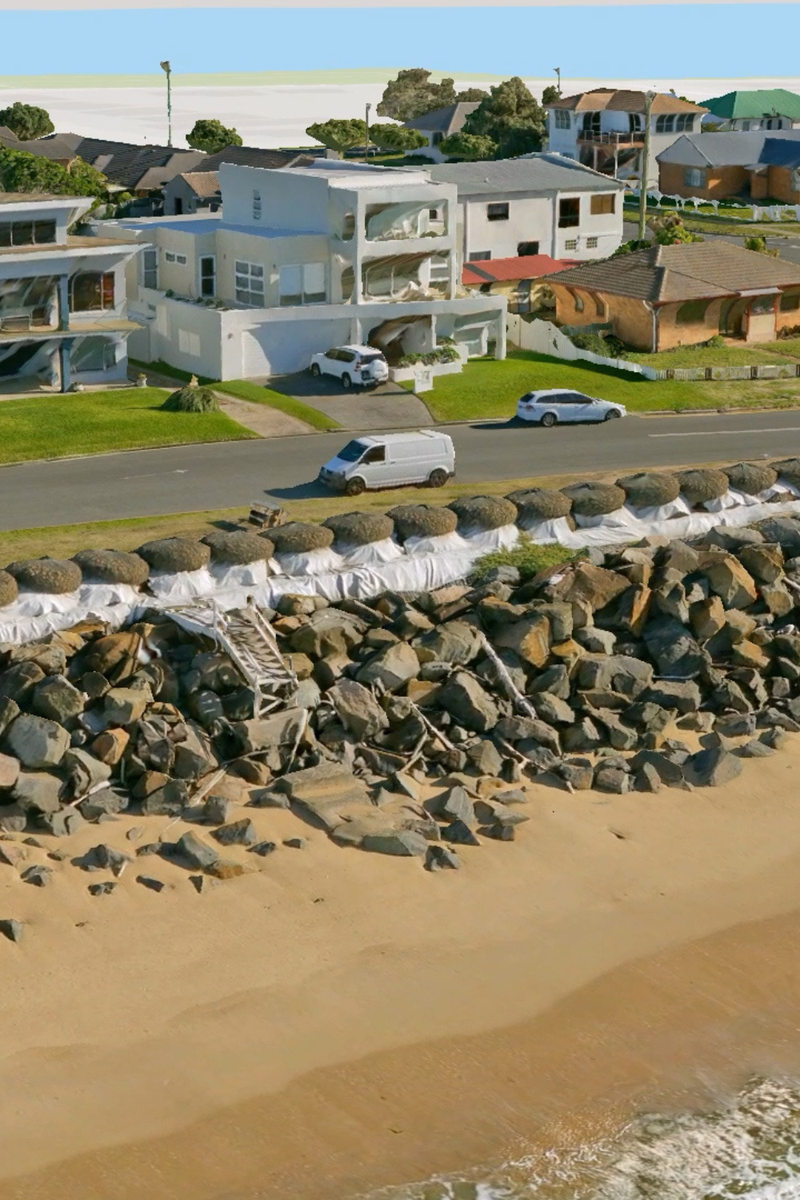
3D mesh reality models combine aerial imagery and spatial geometry to create detailed, photo-realistic representations of built and natural environments. In insurance and financial services, 3D models support complex risk review, asset understanding and scenario communication.
These models are particularly useful for high-value assets, dense urban areas and locations exposed to environmental risk.
3D data allows your team to:
Where available, pre-existing 3D datasets can also provide a cost-effective way to access detailed visual context without commissioning new capture.