Speaker: Bailey O'Brien, 3D Visualisation Specialist, Aerometrex
Presentation Highlights:
In this presentation, Bailey talks about the work undertaken by Aerometrex to assist the City of Melbourne and the Victorian State Government with their aspirational, forward thinking project.
The Greenline Project is a transformational program that presents a new vision for the City of Melbourne.
A 4-kilometre pathway across five precincts will connect vibrant riverside destinations, stretching from Birrarung Marr to the Bolte Bridge in Docklands. It will integrate Aboriginal culture and engagement at every stage of the design and delivery process, and its ongoing programming and management.
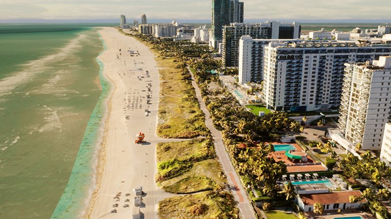
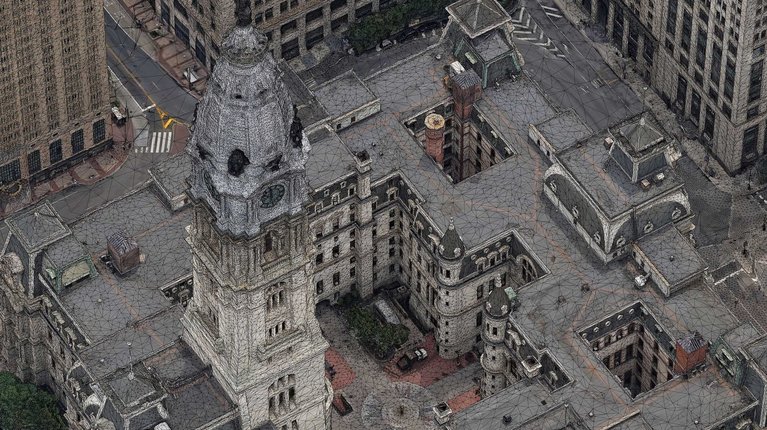
Aerometrex played a major part in stage 1 of the program by capturing and delivering the 4-kilometre pathway as a 3D dataset to the City of Melbourne and the Victorian State Government Department's Vicmap Geospatial Data and Analytics Panel. The multi-resolution 3D mesh model included the highest-resolution street level imagery captured on foot, by boat and via drone for the ultimate human-scale viewing, including 2cm resolution imagery captured by helicopter for broader context for the project area.
The project team at Aerometrex spent over three months imaging the iconic Melbourne Yarra River – Birrarung’s north bank and the surrounding areas with the 3D data being delivered ahead of schedule for this landmark project. Resulting in a successful collaboration between Aerometrex, City of Melbourne and the Victorian State Government Department's Vicmap Geospatial Data and Analytics Panel.
The 3D mesh model will now be involved with the early investigation works, stakeholder engagement, consultation, and detailed engineering design for elements at all levels. The delivery as a 3D dataset will also provide a basis to develop a digital twin of the Greenline Project.
The master plan for this project along with the high-resolution 3D mesh model will also help provide a framework for the Greenline Project, one of the biggest city-shaping projects in Melbourne’s history.
Listen to Aerometrex's Bailey O'Brien's presentation showcasing recent work undertaken to deliver a high-res 3D dataset for The Greenline Project for City of Melbourne & the Victorian State Gov.