
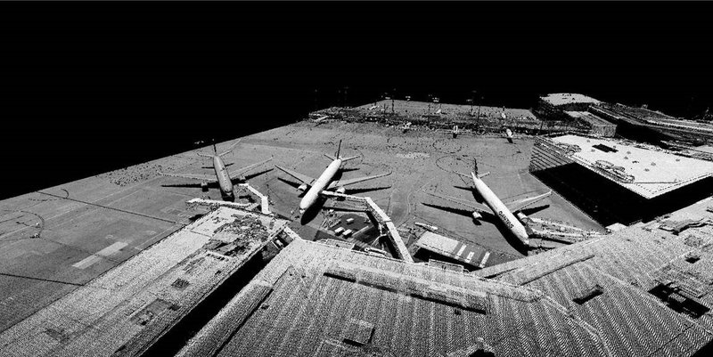
The Melbourne Airport is a challenging place to capture spatial data crucial to operations. In 2021 Aerometrex rapidly captured LiDAR data with no disruption to business, giving the airport valuable, large-scale, and high-resolution datasets that will support them for years to come.
We spoke to Melbourne Airport’s GIS Manager Dustin Edge about why he chose Aerometrex’s aerial-captured LiDAR for Melbourne Airport and the benefits that spatial data will bring over time.
The Civil Aviation Safety Authority (CASA) has stringent safety standards that airports must adhere to and spatial data is crucial validation for airports. Dustin explained just how vital the LiDAR capture was for Melbourne Airport, and indeed any airport:
“The LiDAR capture played an integral role in a compliance reporting to CASA. If we don’t meet compliance, we run the risk of losing our aerodrome licence or being downgraded. It was that level of importance. One of the reporting criteria is to prove that our runway, aprons, and taxiways are effectively flat at 1% grade or less.”
The Melbourne Airport LiDAR can now give accurate data by request when required, and Dustin is expecting the resolution to provide them with all of the detail they need for compliance.
“At 16 points per meter the triangles are really small. So that gives you that level of confidence that our runway is in good condition. We can report back in much better detail from that resolution. So that was the reason I wanted the LiDAR.”
Melbourne Airport is challenging to capture from both aerial and terrestrial platforms, as Dustin describes;
“We are a 24-hour, seven-days-a-week airport. So trying to get clearance to go work on the runways and capture spot levels is very difficult. Taking readings on a three-kilometre long strip is going to take a long time, especially when you have to keep stopping for air traffic. The minute you have that kind of labour, your cost goes through the roof because the only way you can really prove that your runway is flat is if you take more readings.”
The solution was a single nighttime capture when the airport isn’t functioning. LiDAR scanners capture as accurately at night as during the day. The entire capture was completed within a single sortie by Aerometrex, with rapidly processed data.
“From one capture and a week of processing, we’ve got all the runways, aprons, and taxiways. Now I could do the slope analysis on any part of the airfield I wanted. I can just pull up a cross-section anywhere I wanted and generate that data,” explained Dustin.

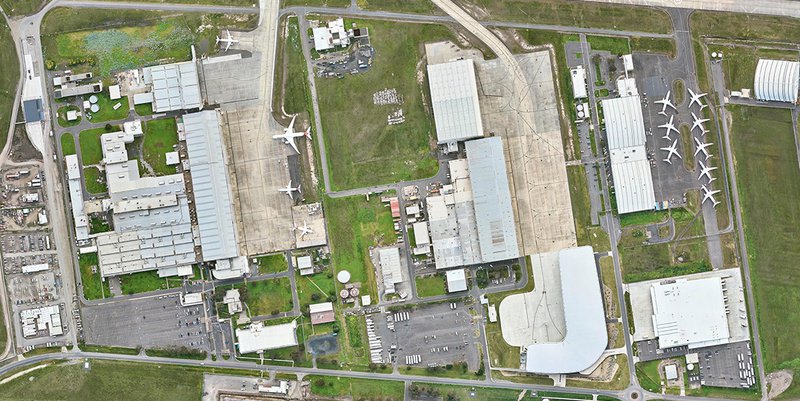
Melbourne Airport is Australia’s largest business park in addition to Australia’s second busiest airport. The LiDAR capture data, added to their substantial use of 2D MetroMap imagery, helps multiple teams across the Airport precinct with their GIS activities, as Dustin explains;
“The spinoff from the LIDAR is just going to be tenfold. Besides that initial runway compliance piece, I’m going to use it to check objects for height assessments and other 3D modelling activities. I can also show what the growing Business Park is going to look like in 3D”
Both Aerometrex LiDAR data and MetroMap imagery helps the Melbourne Airport manage its complex spatial needs. Read about How Melbourne Simplifies GIS for Melbourne Airport.
Contact Us with the form below if you’d like to talk about LiDAR or other spatial data.