25 Sep, 2024
Aerometrex has been awarded a high-resolution 3D reality mesh program for up to $0.68 million with the South Australian Department for Environment and Water (DEW).
This 3D reality modelling project involves oblique imagery capture, from a helicopter at 2cm resolution, and the production of 3D models and derivative products. The 3D models will enable volumetric analysis to quantify the volume and position of sand changes – enabling important predictive analysis for DEW in its coastal management initiatives.
Aerometrex’s unique and leading high-resolution 3D capabilities are an important input into this type of investigation and analysis.
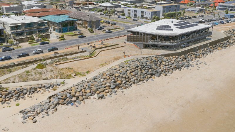
This is an important project that shows the value of high-resolution 3D reality mesh in the environmental management of coastal protection. It builds on the successful completion of a coastal capture pilot project for DEW’s Coast Protection Branch in January 2024. This project aligns with Aerometrex’s key strategic initiatives to support critical sustainability and environmental management projects and the positive impact that this can have on our community.
Steve Masters, CEO & Managing Director, Aerometrex
Aerometrex’s capability and wide-ranging service offerings cover various industries and use cases. Recent examples of high-resolution environmental applications include support of bushfire fuel load management, surface water management, erosion modelling, and informed agriculture including carbon credits and catchment impacts on the Great Barrier Reef.