22 Oct, 2020
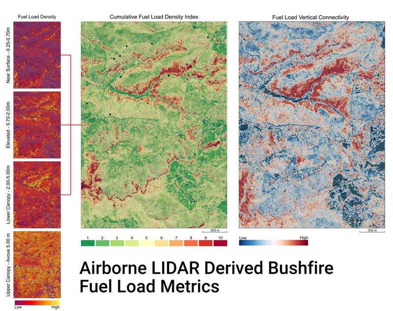
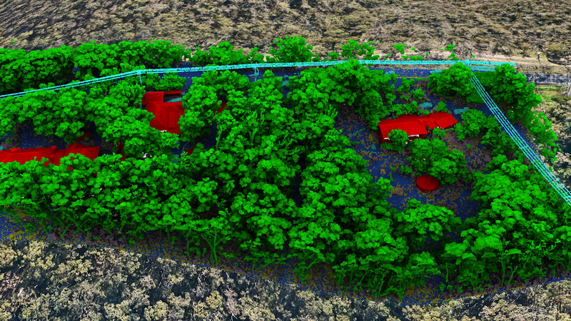
Aerometrex is pleased to announce that it has developed a new technology that can determine, in three dimensions, the exact fuel load densities in any bushfire prone region in Australia. The product is an advance of the company’s existing LIDAR (Light Detecting and Ranging) technology and was developed over 2020 in conjunction with government and industry in the wake of the disastrous Black Summer fires across Australia during the 2019-20 fire season. The technology will be available to authorities ahead of this year’s bushfire season. It surpasses current and historic fuel load methodologies by delivering and visualising data not possible to be collected or “seen” from conventional satellite, aerial or drone imagery fire-fighting tools. Its real-time and ultra-high data capture of fuel load density underneath tree canopies is achievable regardless of location, terrain type, ground cover or accessibility.
We know where the fuel is and how much.
Let's assist our fire-fighting heroes in saving lives this fire season.
The LiDAR-driven technology employs up to two million individual laser pulses per second emitted from a sensor within an aircraft as it flies above the area of interest. By measuring the time taken for each laser pulse to travel down to the surface and get reflected to the aircraft, the precise location of the point of reflectance can be calculated in three dimensions.
Since LIDAR technology explicitly measures the landscape in three dimensions, it is often free of geometric distortions that can be associated with other imaging techniques. When an individual laser pulse is incident on a tree, shrub or any other vegetation, some of the energy is reflected back to the sensor from the very top of the vegetation and some energy penetrates through the canopy and accurately images the internal structure of the vegetation and even the ground below.
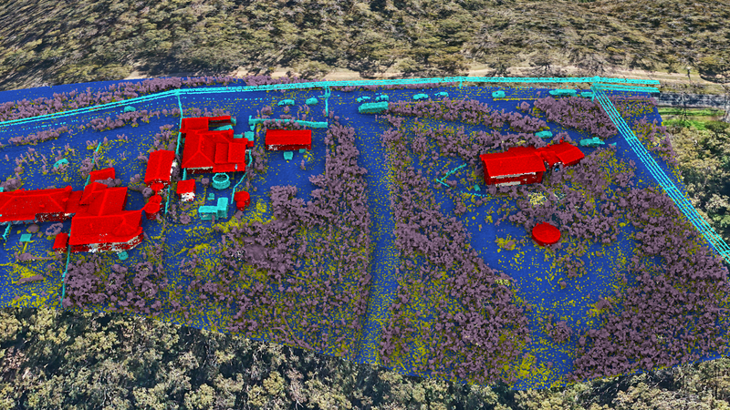
This penetrating power delivers a far more accurate image of vegetation and is more sensitive to variations in vegetation structure and density compared to remote sensing techniques such as satellite imagery and RADAR. Data from the advanced LIDAR technology then allows for the extraction of understorey fuel load estimates that would otherwise be fully obscured from view in satellite or aerial imagery by overlying canopy. It can be scaled from a single metre by metre square, up through the needs of a single home, to a local community, onto a fire-fighting team and right up to an entire region and is accurate in 3D down to a height of 25-50cm above ground.
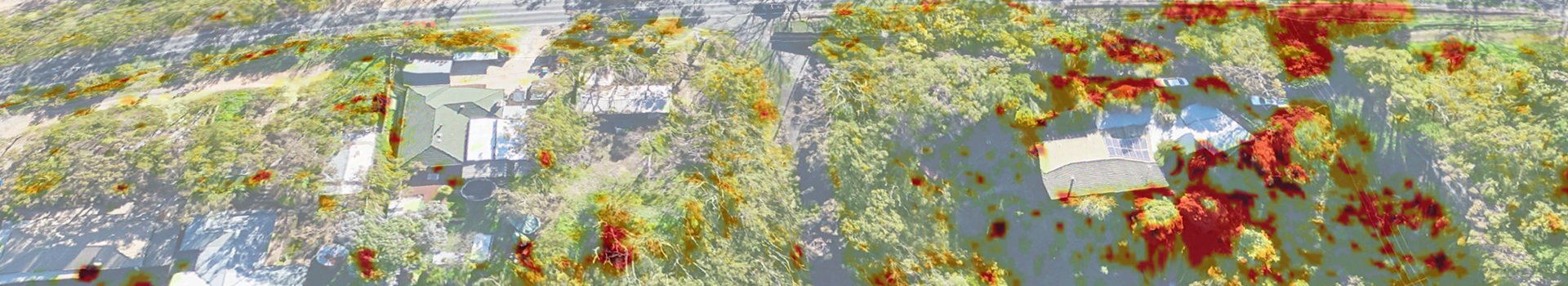
LiDAR with view of trees and built up areas
LiDAR with upper tree canopy stripped
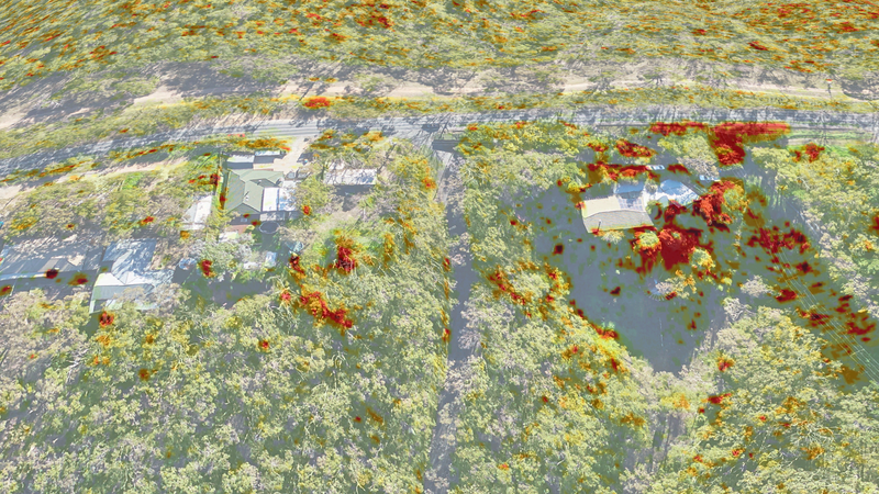
LiDAR showing fuel load density (red - high fuel load)
Aerometrex’s R&D program for the new technology included tests across 10 sites within the heavily vegetated Belair National Park in the Adelaide Hills. As ground fuel loads are one of the primary causes behind the intensity and scope of evolving bushfires, along with prevailing weather conditions, quantifying fuel loads and overall fuel hazards is a fundamental step in future bushfire management and planning and for better understanding of the risks posed by bushfires to the community, the economy and the environment.
The outcomes and product development from this research are both timely and relevant following the detailed recommendations of the Bushfire Royal Commission, state-level bushfire inquiries and the final reports published by the Bushfire & Natural Hazards CRC. Many of these reports highlighted remote sensing technologies such as LIDAR as critical resources that have the potential to revolutionise bushfire management and response practices following the 2019/2020 Australian bushfire season.
It is understood to be the first system able to standardise the capture of LIDAR for the purpose of bushfire fuel load mapping in Australia and we believe the breakthrough should allow emergency authorities, government, and communities, to adopt a far more science-based and pre-emptive fuel load strike position ahead of this year’s bushfire season.