As we face new climate challenges, councils and governments seek smarter, more accurate and up-to-date data to map, manage and monitor urban areas. Spatial data leads the way, providing precise insights into urban vegetation that can be used to set and achieve environmental targets.
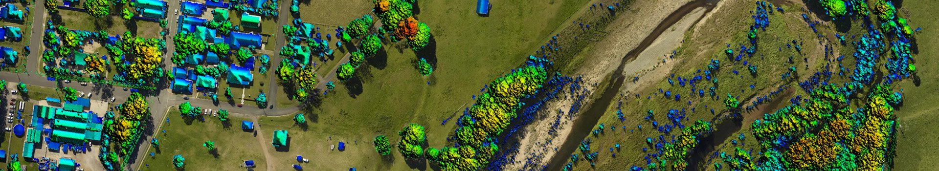
LiDAR (Light Detection and Ranging) works by sending out a laser pulse from a sensor mounted to a plane, and measuring how long it takes for the pulse to bounce back from the surface. This tells us exactly where it was reflected back from, as well as its height above ground and location in space. In other words, it is a remote sensing method for measuring distances where the target is illuminated with laser light and the reflection is measured with a sensor.
The landscape is then instantly imaged in 3D, allowing us to generate distortion-free datasets – a distinct advantage over 2D imagery.
Urban forests (which encompass all the trees in the urban environment and community) play a pivotal role in reducing runoff and pollution, supporting wildlife, boosting property prices, and cooling cities. By understanding the existing trees and canopy, policymakers can make more informed decisions for maintaining and improving local tree assets to build sustainable cities.
With LiDAR, we can measure fundamental vegetation metrics of urban forests, such as the exact canopy height and cover at various intervals. This is then used to generate a stratified map, showing the above-ground height of the treetop coverage.
As well as looking at the tops of trees, LiDAR can penetrate the canopy to reach the ground, offering richer information for data collection. Our article, Urban tree canopy management and LiDAR, goes into more detail.
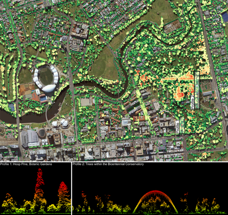
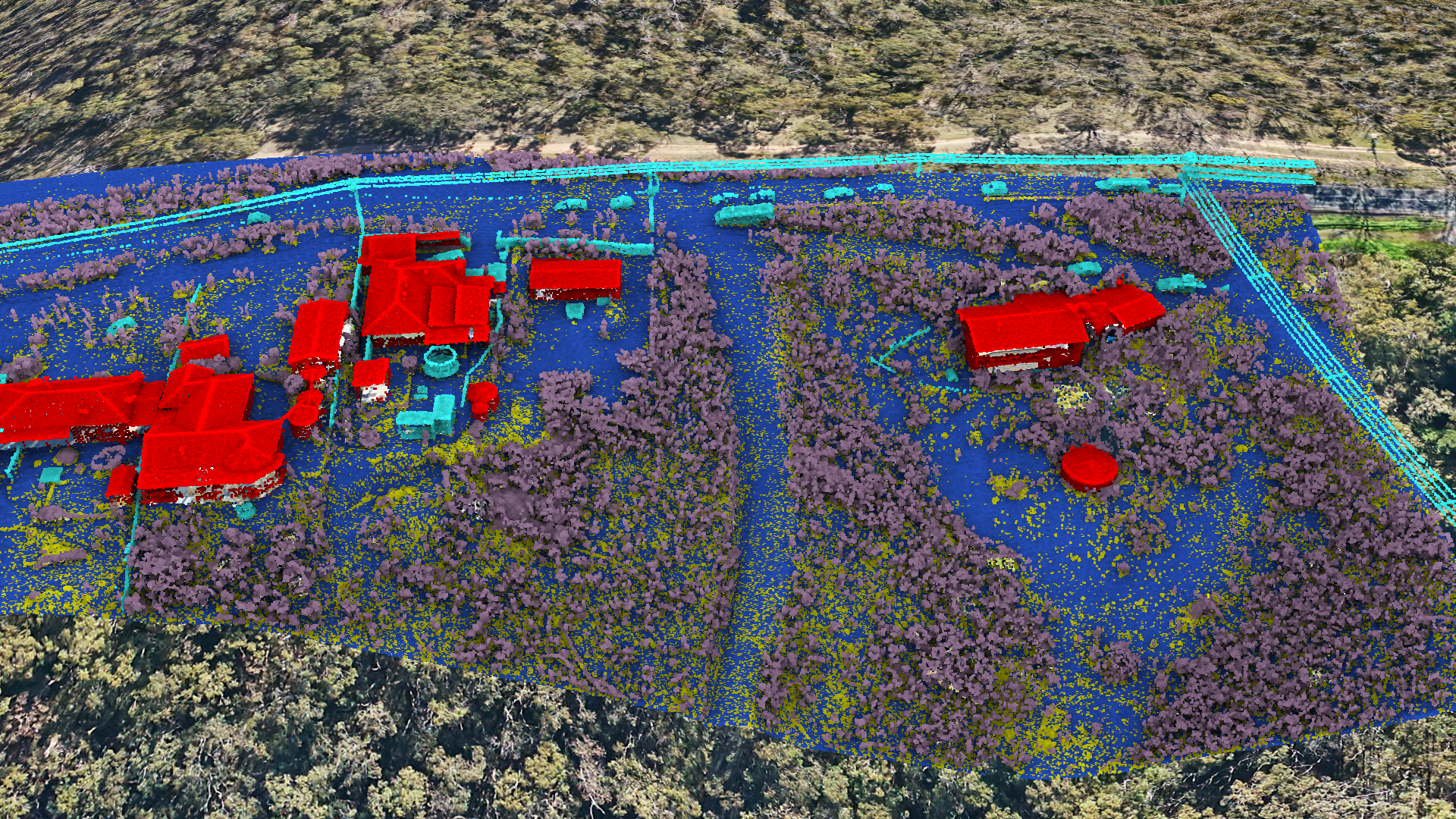
Figure 1. A Digital Canopy Model showing the tree canopy above 3m across northern Adelaide. Canopy is colour coded according to height above ground (green = low, red = high). Profile 1: shows the three-dimensional structure of the tallest tree in the Adelaide Botanic Gardens, an approx. 45 m tall Hoop Pine, derived directly from a LIDAR point cloud. Profile 2: A detailed three-dimensional model of the Bicentennial Conservatory, as well as the trees growing within it. Classified LIDAR point clouds allow users to easily isolate man-made structures, the ground surface and vegetation.
In an era of sustainable smart cities, LiDAR systems offer invaluable insights. Perhaps one of the biggest benefits is that it doesn’t only capture urban forests. It also creates a detailed 3D model of the surrounding urban environment, including individual buildings and terrain.
By repeating the measurements over time, we can track changes to the tree canopy (such as canopy loss) and see where they occur – such as council land versus private land – and how they will impact future decision making.
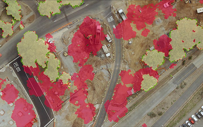
Tree Canopy Change map. Red is canopy loss, green is canopy gain, yellow is unchanged canopy.
For instance, mapping the tree canopy across the entire Adelaide metropolitan area revealed that significant canopy loss on private properties was offset by tree growth.
Insights such as these provide the end user with vast opportunities, compared to 2D imagery. For example, the data can be used for flood modelling, capturing accurate building footprints for urban planning, or segmenting individual trees for asset management. It can also help councils avoid urban heat islands, which occur when too much natural land is replaced with heat-absorbing surfaces and buildings.
It’s clear that LiDAR is innovating the way we map urban vegetation – especially when paired with other datasets, such as aerial imagery. And with the ability to extract various vegetation metrics from our LiDAR datasets, state and local governments can better manage their urban forests while working towards their environmental goals.
Looking ahead, we expect to see LiDAR being used as a foundational dataset to guide bushfire fuel load mapping and risk mitigation efforts across Australia. By imaging the vegetation in 3D, we can gain a greater understanding of both the density of the canopy and the vegetation close to the ground – which helps predict the fire intensity and speed as it spreads.
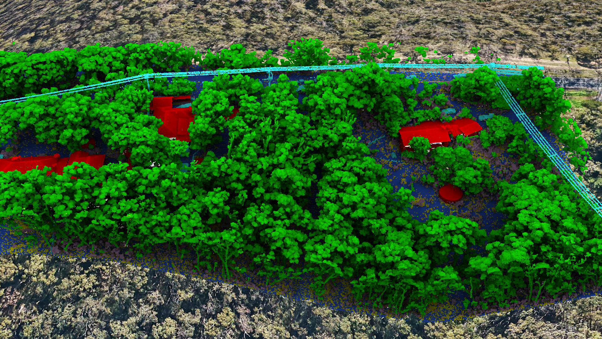
LiDAR is a powerful tool for bushfire fuel load mapping.
And that’s only the beginning. As our cities continue to face new challenges, we’ll rely on powerful tools such as LiDAR even more to help measure and manage the environments in which we live and work.
If you’d like to see how LiDAR can help you plan for the future, visit our LiDAR page or get in touch with us today.