Access a range of 3D solutions that provide context to your projects, help develop and visualise scenarios as well as offer a comprehensive 3D base dataset for change monitoring.
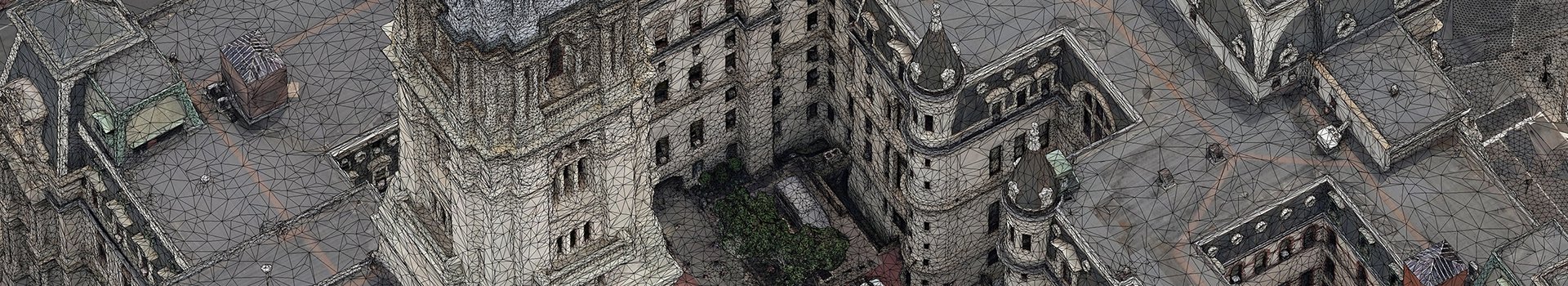
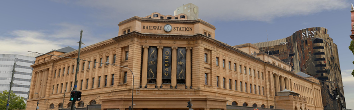
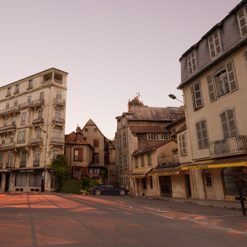
Our award-winning 3D modelling service provides an end-to-end solution: the whole workflow from flight planning and image acquisition to 3D processing and geo-registration is all done in-house. We have executed numerous projects that combine aerial acquisition from multiple platforms (aircraft, helicopters and UAVs as well as street-level imagery) and use the data generated to build a seamless 3D mesh model or ‘reality mesh’.
Check out 3D city models ready to buy as a whole, or clip the area you need via our MetroMap Store.
View City ModelsWe work with you to tailor the best solution in terms of application, image resolution & accuracy.
Contact Our Team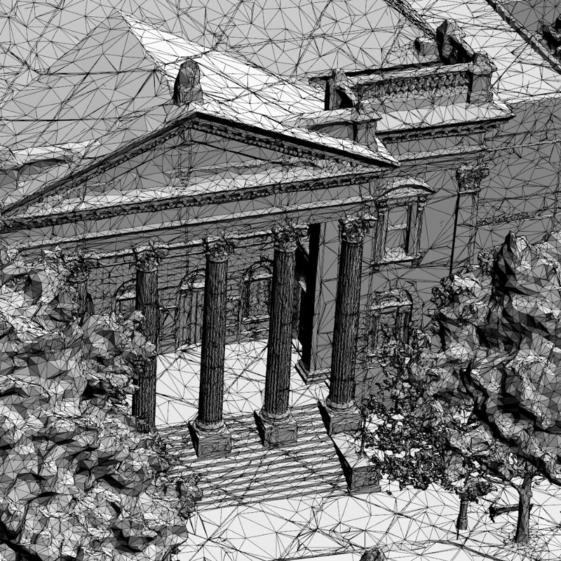
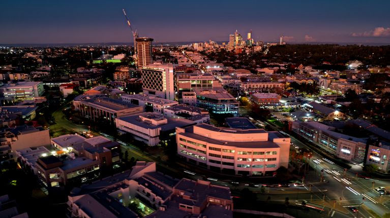
3D Mesh Models
Our flagship 3D solution offers you standard, high, and ultra-high detail based on your requirements, delivered to you in a range of compatible formats and accessible as downloadable files or via API services such as 3D Image Dedicated for companies running an Esri suite.
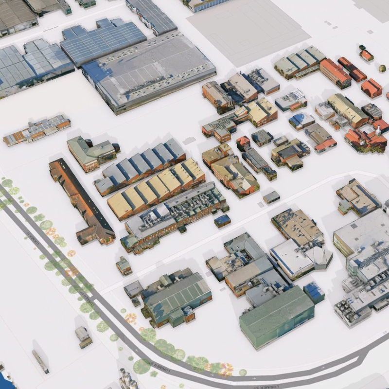
3D Building Models (LODs)
Our 3D Building Models are derived from highly accurate 3D mesh models, and available in different LOD (Level of Detail). This output helps when planning requires building isolation & attributing. They are lightweight & storage-efficient, ensuring seamless integration into your systems.
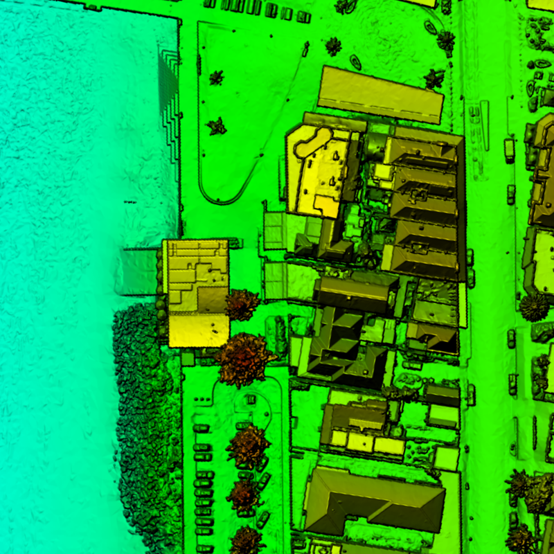
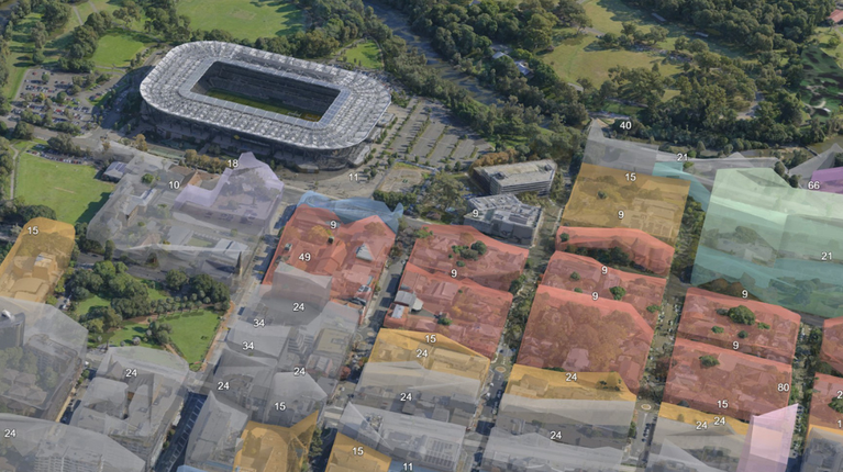
3D-Derived Elevation
Elevation and topography datasets derived from 3D mesh models can be extremely useful for city-wide urban planning, landscape-scale groundwater management, flood mitigation planning, local engineering works, and various other applications.
3D Visualisation
Our visualisation services can support your organisation with more advanced and interactive solutions to complement stakeholder communications, presentations or reporting. Take your visualisation efforts to the next level with the help of our experts.
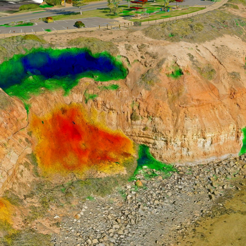
3D Change Analysis
Conduct analysis for improved planning & decision-making using our 3D change analysis service. With multiple captures, we can help you analyse change over time for a range of assets. This can especially be useful for regulatory planning and management.
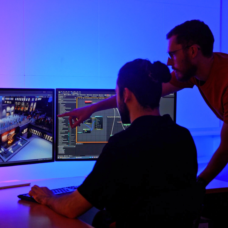
3D Consulting Services
Our 3D consulting services act as an extension of your internal teams, freeing up resources for critical tasks. For organisations new to 3D data, our cost-effective consulting services simplify the implementation and use of 3D data within your business.