Forestry, agriculture and carbon farming projects depend on accurate, defensible spatial data to quantify vegetation, understand terrain and demonstrate outcomes over time. Aerometrex delivers aerial LiDAR, imagery and spatial modelling solutions that support commercial forestry operations, land managers and carbon project developers in making confident, data-backed decisions at scale.
With extensive experience supporting large, complex LiDAR projects, including carbon credit and environmental initiatives, we provide the spatial intelligence required to measure, manage and report on land-based assets with confidence.
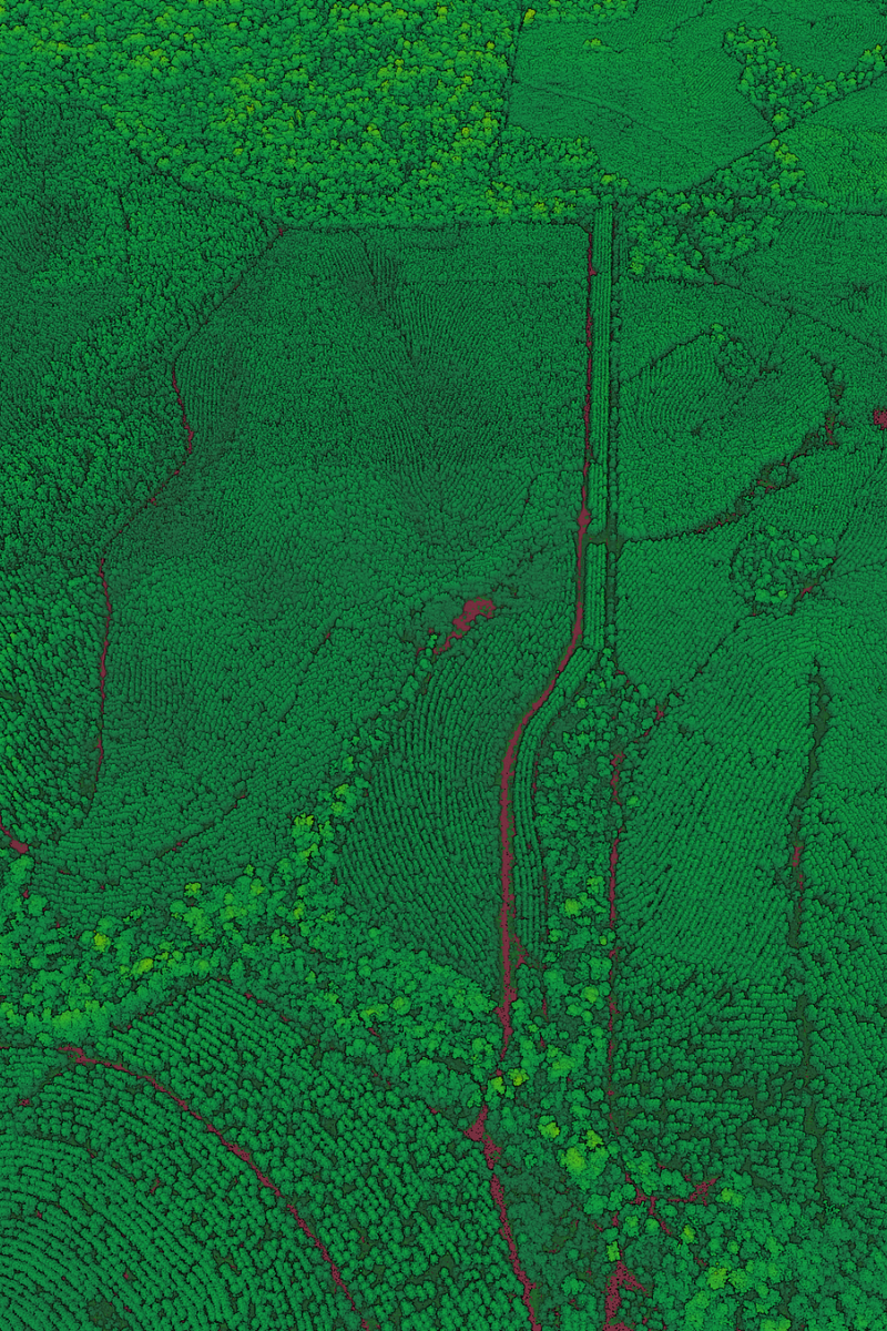
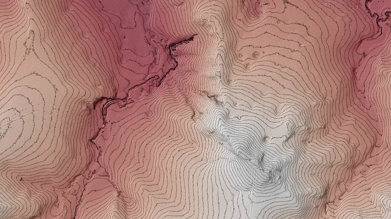
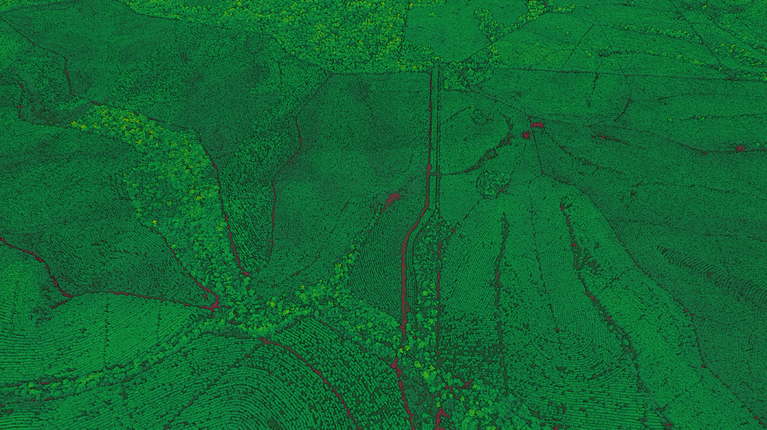
Aerial LiDAR plays a critical role in modern forestry and carbon farming by capturing detailed information about vegetation structure and ground conditions across large areas. It enables consistent, repeatable measurement that supports both operational planning and long-term environmental outcomes.
Aerometrex delivers high-quality LiDAR and derived datasets, including classified point clouds, elevation & vegetation datasets, tailored to project and reporting requirements.
Using this data, forestry and carbon project teams can:
Beyond commercial forestry, LiDAR also supports broader land and vegetation strategies, including reforestation, regeneration and urban greening initiatives, where accurate canopy and terrain data underpins effective planning.
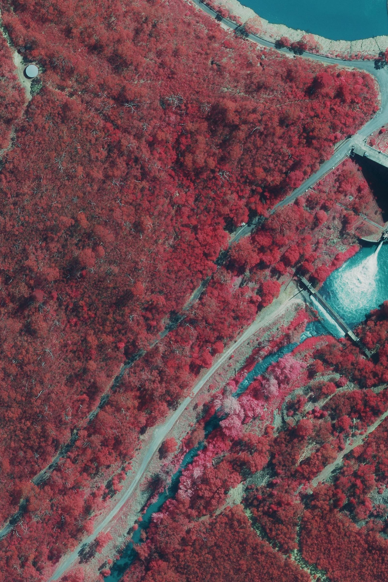
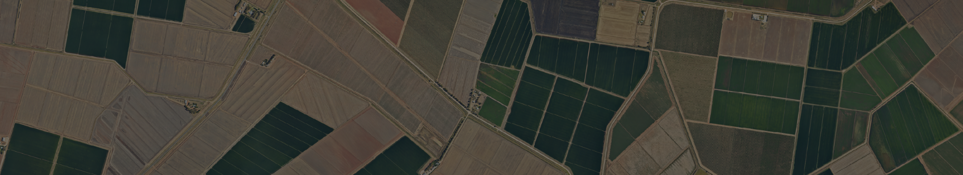
High-resolution aerial imagery provides essential visual context for forestry, agricultural and carbon farming projects. In addition to standard RGB imagery, Aerometrex supplies near-infrared (4-band) imagery through MetroMap, enabling teams to better assess vegetation condition and patterns across large areas.
This combination of visual and spectral information supports both operational decision-making and long-term land management.
Using this imagery, teams can:
Aerometrex supplies aerial imagery through MetroMap, our subscription-based imagery platform, as well as bespoke captures where required. Regular updates make MetroMap particularly valuable for organisations managing long-term forestry, agricultural or carbon projects.
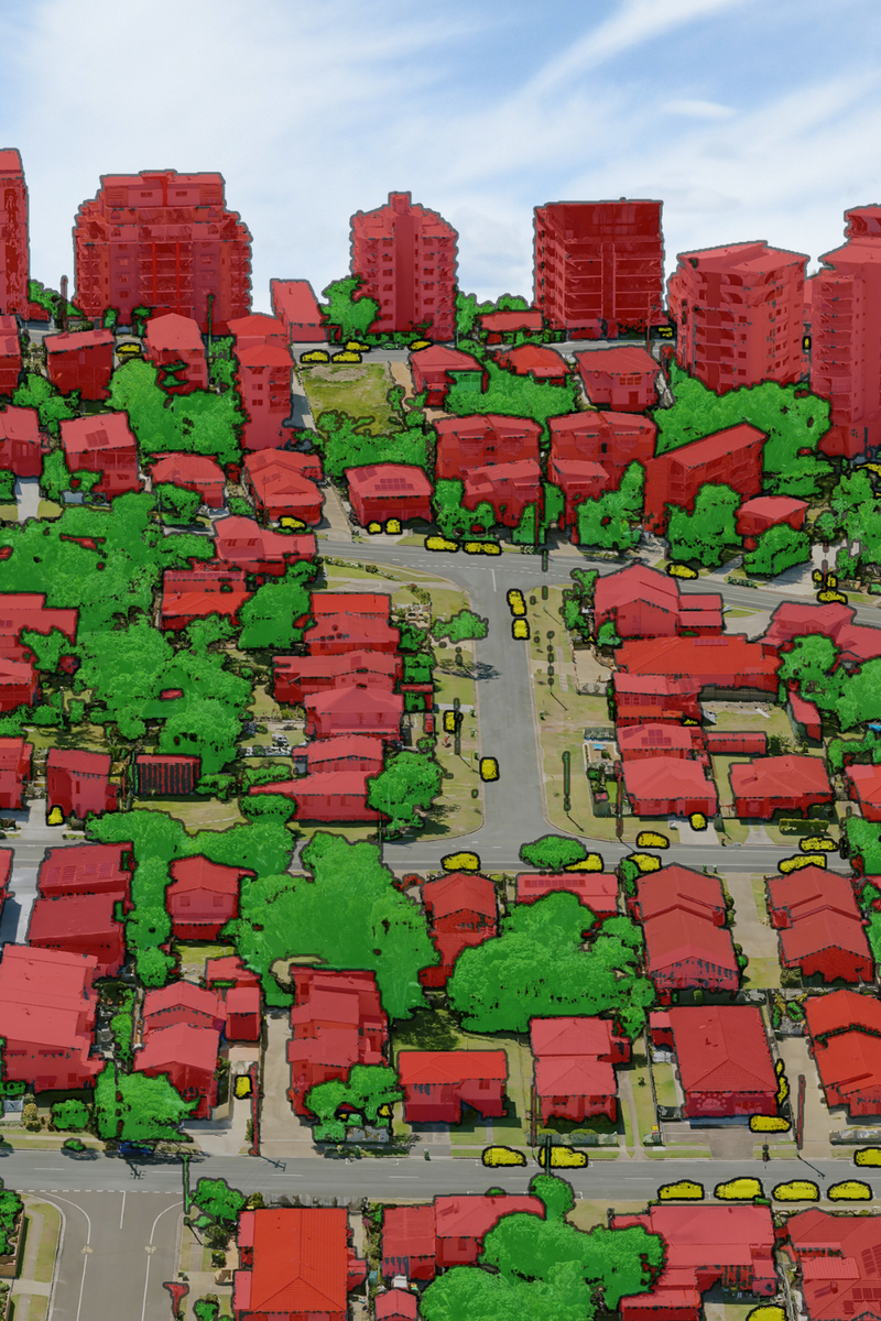
3D mesh reality models transform spatial data into photo-realistic representations of landscapes, making complex forestry and land management projects easier to understand and communicate.
In forestry, agriculture and carbon initiatives, these models help teams:
While LiDAR remains the primary analytical dataset, 3D reality models add significant value by translating data into intuitive, decision-ready visuals.