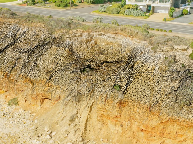
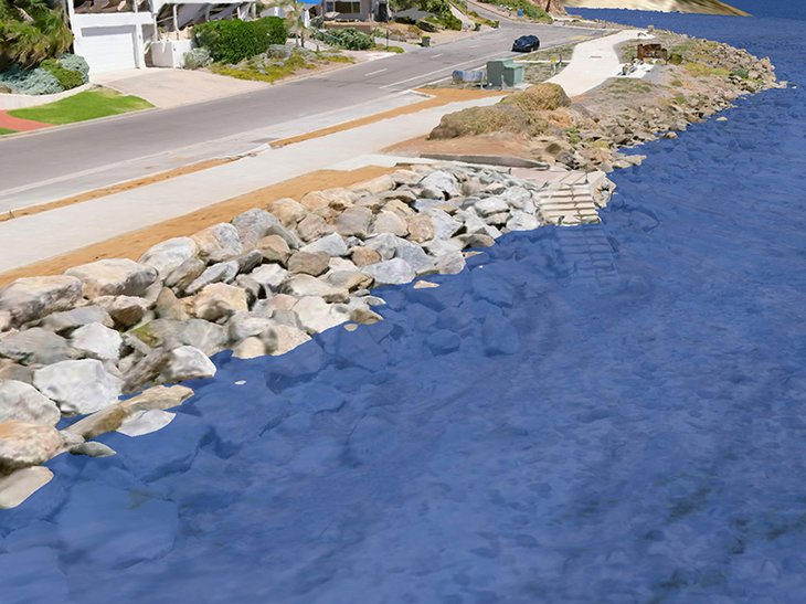
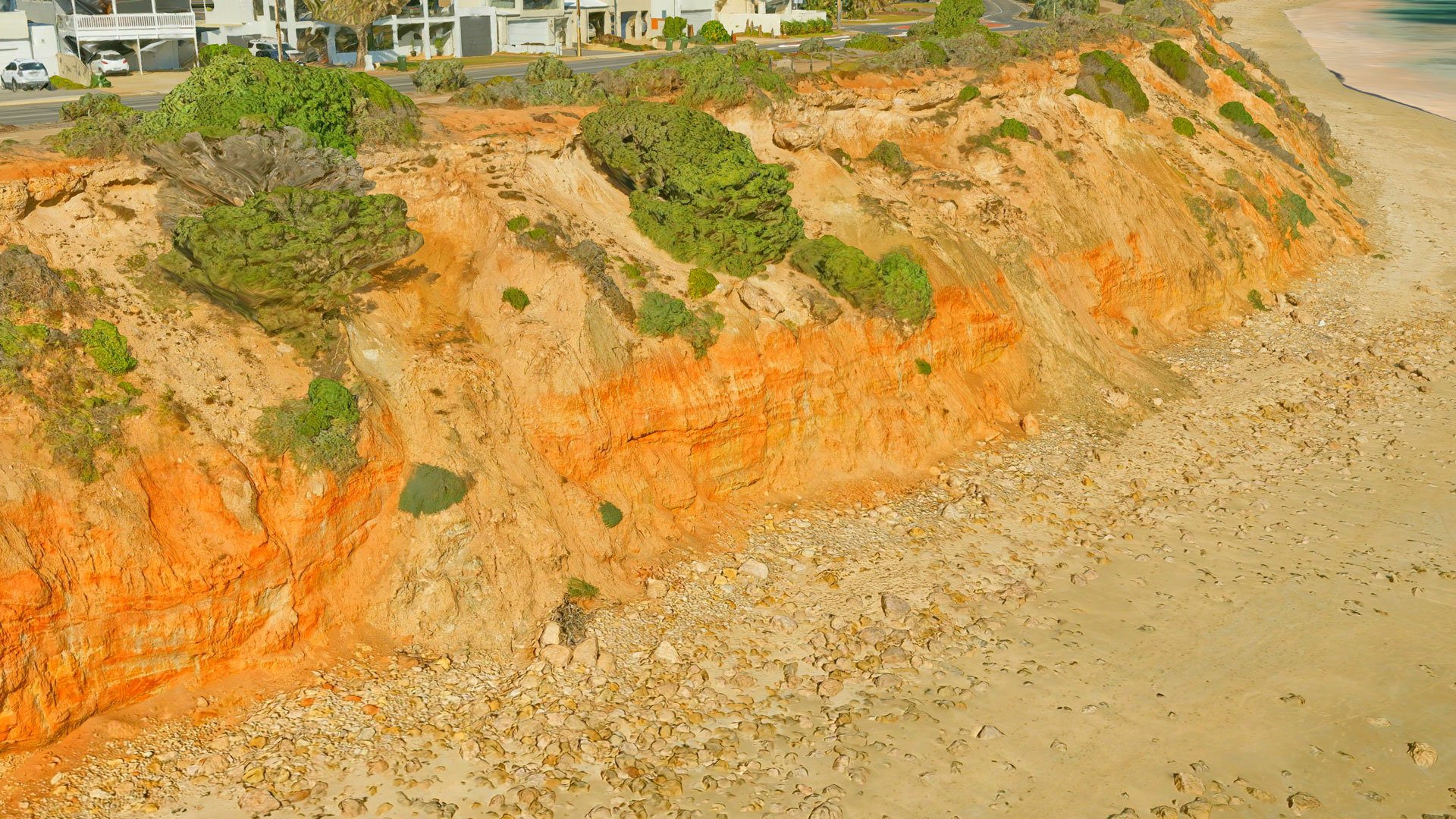
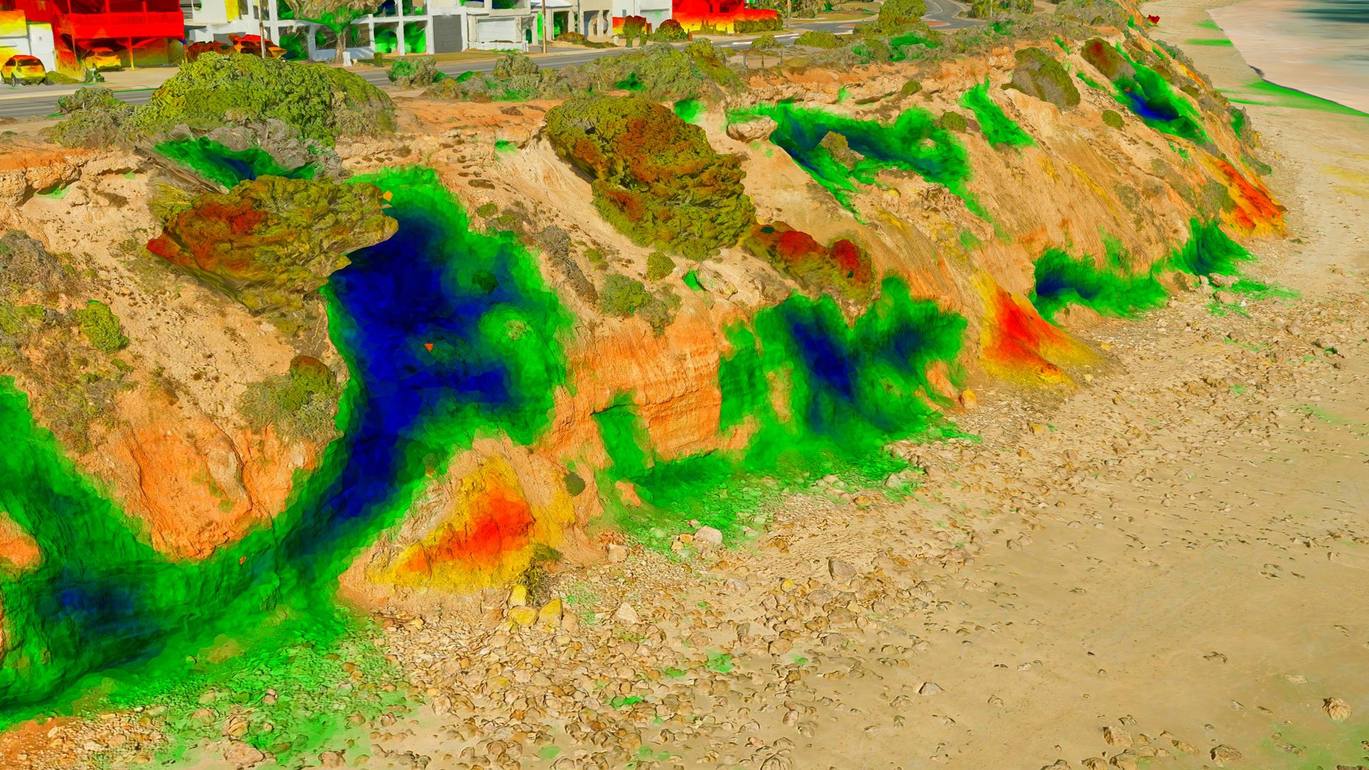
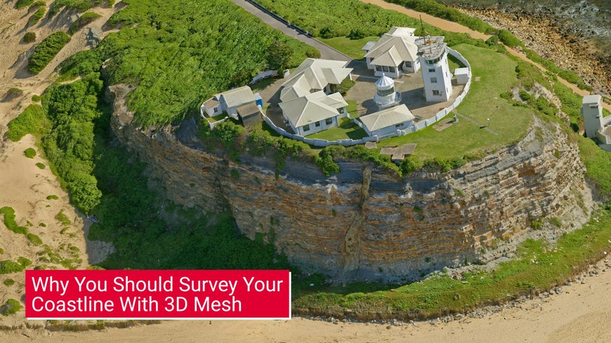
Aerometrex 3D photogrammetry models combine high-resolution imagery with ground-controlled survey data, for spatial accuracy, for measuring and monitoring change in natural and built coastal environments. Visually assess, measure, and inspect your coastal areas remotely.

Aerometrex Website
CONTACT US

3D mesh data serves multiple users such as urban planners, asset managers, and broader GIS teams.


Volumetric analysis:
  • Measure cracks, fissures, and landslides with flexible oblique views of cliff faces and undercuts that can’t be matched by nadir perspectives.
Change analysis:
  • Identify, measure, and communicate change across multiple captures with the help of enhanced reporting for your council showing the location and quantum of change.
  • Analyse mobile ground types, monitor changes in sand dunes, or measure movement in manually relocated sand.
Emergency Preparedness and Recovery:
  • Build a historical record of your coastal environment using an initial capture.
  • Drive post-disaster damage assessment and recovery activities using subsequent captures.

Aerometrex 3D offers you a range of benefits over other survey technologies.

High spatial accuracy:
  • Combining high-res 2 cm imagery and ground control survey points offers accuracies of 5 cm (RMSE)
  • Higher point density enables accurate volumetric measurements & change analysis.
Greater detail:
  • Targeted oblique imagery captures more detail on steep terrain, vertical surfaces, and overhangs than nadir perspectives.
  • Inspect remotely with high-detail 3D representations of the coastline
Simplified, efficient and non-disruptive surveying:
  • Mobilize fewer people and surveying assets compared to current beach monitoring methods.
  • cover in hours an area that may take a drone multiple days.
  • capture fully populated coastlines without disruption.

Aerometrex's spatial team can generate reports for your council that include colourised mesh datasets to identify change location and quantity.

no-colour-web-4.jpg colourised-mesh-web-4.jpg

Some of the coastal councils using Aerometrex 3D data

 
MAP YOUR COAST WITH 3D MESH

See what you can do with our range of 3D data solutions

OUR PRODUCTS

  • 3D photogrammetry mesh
    • 2 cm resolution
    • Ground control survey data
  • Colourised 3D mesh
  • Streamable Esri / Cesium environments to visualise the data.
  • Volumetric reports with measured change.
  • Consulting service to better manage and use the data.
  • Common formats:
    • Esri SLPK
    • Obj and fbx for other uses
  • Other 3D mesh-derived products:
    • Point cloud
    • Digital Surface Models / Digital Terrain Models
    • True Ortho imagery
X