As the demand for carbon farming and sustainable land management rises, accurate property assessment and land classification are crucial. Many consulting firms still rely on outdated, manual or low-accuracy methods, leading to missed opportunities in carbon sequestration, lower integrity credits and reduced commercial outcomes.
Airborne LiDAR surveys have proven to be a game-changing solution that provides unmatched precision in carbon stock assessment, land-use monitoring, and compliance reporting.
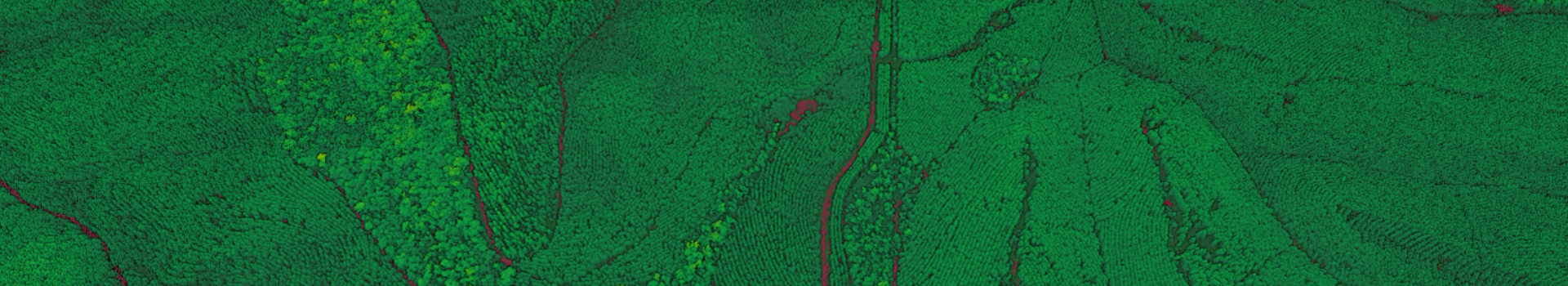
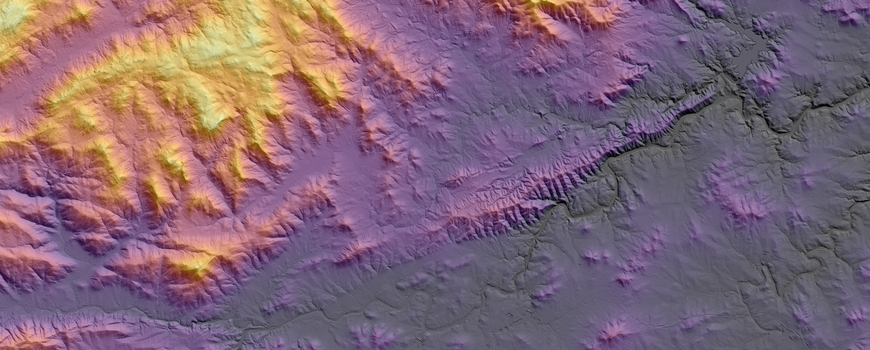
LiDAR (Light Detection and Ranging) is an advanced remote sensing technology that creates highly accurate 3D maps of land, vegetation, and terrain. Unlike satellite imagery or traditional surveys, LiDAR provides granular precision that helps assess carbon potential, vegetation structure and density, and landscape changes over time.
Accurate Baseline Establishment and Monitoring
Enhanced Carbon Stock Assessment and Credit Integrity
Improved Compliance and Reporting Processes
Aerometrex to deliver data for agricultural digital twins & carbon project with Agronomeye & Regenco
Aerometrex's LiDAR data was used to produce a holistic three-dimensional property model to support informed land management as well as underpin a carbon market project. The data was supplied to support critical applications in the sustainable & smart farming segment.
Read MoreGet started with LiDAR today and start leveraging high-resolution data for enhanced carbon assessments.
Speak to our experts to discuss how LiDAR can support your carbon farming projects and experience the impact of LiDAR with real-world examples and sample datasets. We’re always here to understand your requirements and suggest a tailored solution for your next project.
Contact Us

Proven Expertise in LiDAR Solutions
Decades of experience delivering high-quality LiDAR datasets for environmental and land management applications.
Nationwide Capabilities & Tailored Data
Customised solutions for any project size, anywhere in Australia.
Seamless Integration
LiDAR data that easily fits into existing carbon measurement frameworks.