


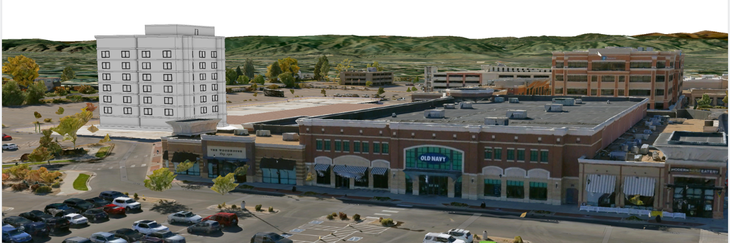
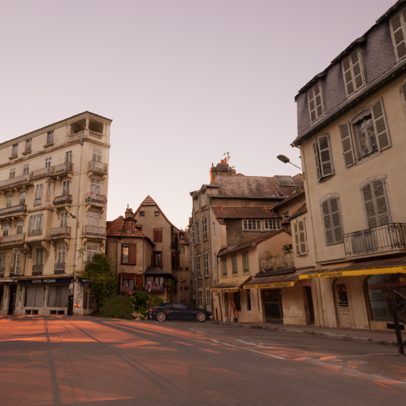
Urban Planning and Development Approvals
Assessing complex proposals can be time-consuming and prone to errors. With high-resolution 3D models, local government councils can visualise developments with precision, identify zoning compliance issues early, and streamline approval processes, saving both time and resources.
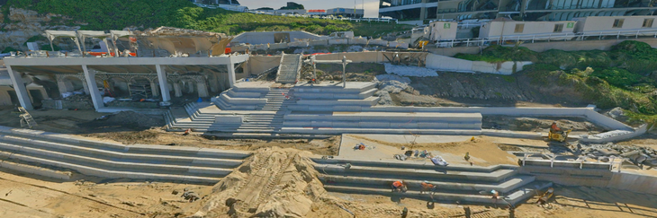
Proactive Asset Management
Managing and maintaining infrastructure is a constant challenge. LGAs across Australia are adding 3D models to their existing workflows to help track assets effectively, detect risks like structural weaknesses, and plan proactive maintenance to maximise infrastructure lifespan and minimise downtime.
Community Engagement and Consultation
Building public trust and fostering transparency can be difficult. Interactive 3D visualisations help local councils communicate plans clearly, engage stakeholders effectively, and encourage meaningful community input, driving trust and participation.
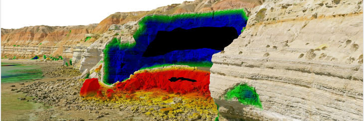
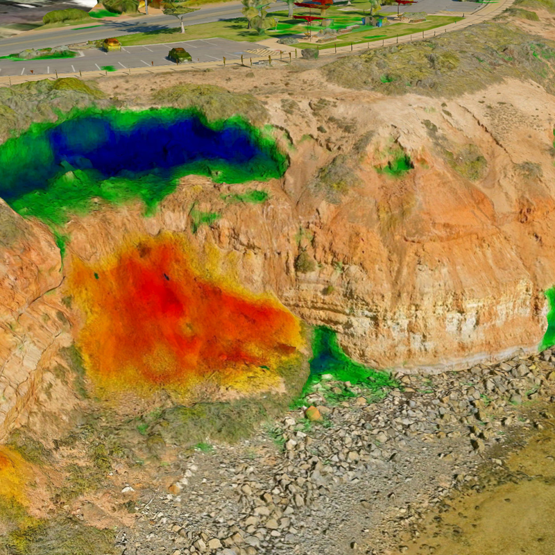
Environmental Conservation and Coastal Management
Monitoring environmental changes, including coastal management can be highly resource intensive. Our 3D solutions enable volumetric and change analysis with high spatial accuracy, helping councils assess environmental impacts, predict erosion, and implement targeted conservation measures.
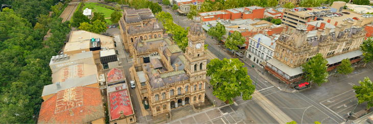
Heritage and Cultural Preservation
Balancing modern development with preserving heritage sites requires careful planning. Our highly accurate and visually compelling 3D models document and integrate cultural assets into urban plans, ensuring respectful development while protecting historical identity.
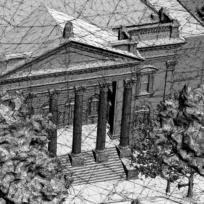
3D Mesh Models
Our flagship 3D solution offers you standard, high, and ultra-high detail based on your requirements, delivered to you in a range of compatible formats and accessible as downloadable files or via API services such as 3D Image Dedicated for local councils running an Esri suite.
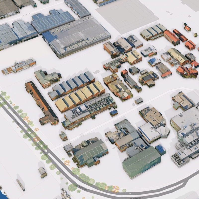
3D Building Models (LODs)
We offer 3D Building Models derived from our highly accurate 3D mesh models, and available across different LOD (Level of Detail). This output is a must when planning requires building isolation and attributing. These models are lightweight and storage-efficient, ensuring seamless integration into your existing systems.
3D-Derived Elevation
Elevation and topography datasets derived from 3D mesh models can be extremely useful for city-wide urban planning, landscape-scale groundwater management, flood mitigation planning, local engineering works, and more.
3D Visualisation
Our visualisation services can support your LGA when you’re looking for more advanced and interactive solutions to complement your stakeholder communications, presentations or reporting. Take community consultation to the next level with the help of our visualisation experts.
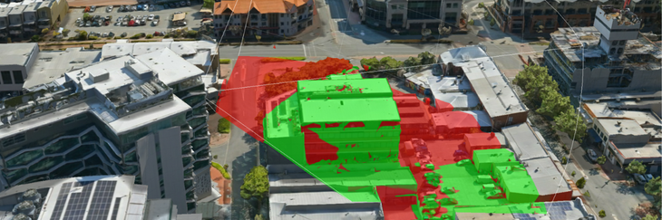
3D Change Analysis
If you’re looking to conduct specific change analysis for improved planning and to support your decision-making process, our 3D change analysis service can assist. With multiple captures, we can help you analyse change over time for a range of assets. This can especially be useful for environmental planning and management.
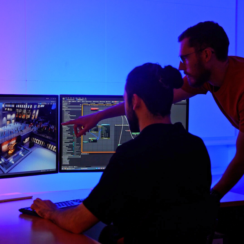
3D Consulting Services
Our 3D consulting services act as an extension of your internal teams, freeing up resources for critical tasks. For councils new to 3D data, our cost-effective consulting services simplify the implementation and use of 3D data within your local government council.