When designed properly, a single Airborne LiDAR survey can provide a suite of highly accurate datasets to help landowners. These datasets can assist in creating informed land management strategies built to maximise productivity whilst prioritising land stewardship. Critically, LiDAR surveys can be collected at regional scales, so landowners are provided with insights to manage specific land parcels within the wider context of the property and landscape.
Classified LiDAR point clouds represent holistic three-dimensional models of the landscape which provide actionable, operational information about the landscape & topography, crops & vegetation as well as property infrastructure. These datasets can be used in a wide range of applications including erosion management, cropping design, surface water modelling, earthworks design and carbon credit/offset schemes.
LiDAR stands for Light Detection and Ranging and is a remote sensing technology that uses laser light to measure distances and create high-accuracy three-dimensional models of the earth’s surface and above-ground features.
Aerometrex uses airborne LiDAR emitting millions of laser pulses per second from a sensor mounted in an aircraft and measuring the time it takes for it to travel to the earth’s surface and be reflected to the sensor. This allows us to create a high-resolution, three-dimensional point cloud model of the earth’s surface, as well as above-ground features such as vegetation, buildings, and other man-made infrastructure.
The airborne LiDAR point cloud can then be fully classified making it possible to produce large-scale derived datasets that accurately describe the elevation and topography of the landscape, as well as the location, height and structure of buildings and vegetation.
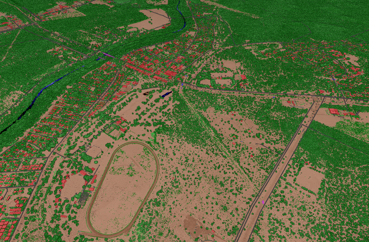
Image: A classified LiDAR Point Cloud of Katherine captured by Aerometrex in 2020
Airborne LiDAR has the ability to penetrate through dense vegetation cover and effectively measure the ground surface below. This makes it the ideal technology to generate datasets that accurately describe the ground surface elevation and topography at a range of scales, from a single paddock to an entire region.
A wide range of elevation and topography datasets can be derived from a single LiDAR survey which can be highly valuable to generate informed land management strategies and support day-to-day operations. A few examples of use cases include:
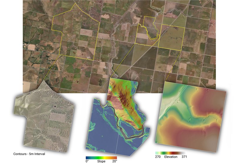
Image: (Top) Aerial imagery with cadastral property parcels overlaid. (Bottom - Left to Right) Cartographic contours, Slope Map, and Digital Terrain Model
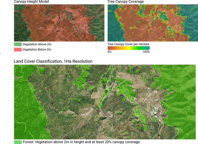
Airborne LiDAR data provides a robust, highly accurate three-dimensional model of vegetation across the landscape. Datasets can be derived that describe the height, vertical structure, and distribution of vegetation within a property. Listed below are a few examples of use cases:
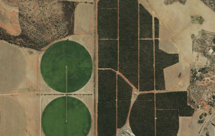
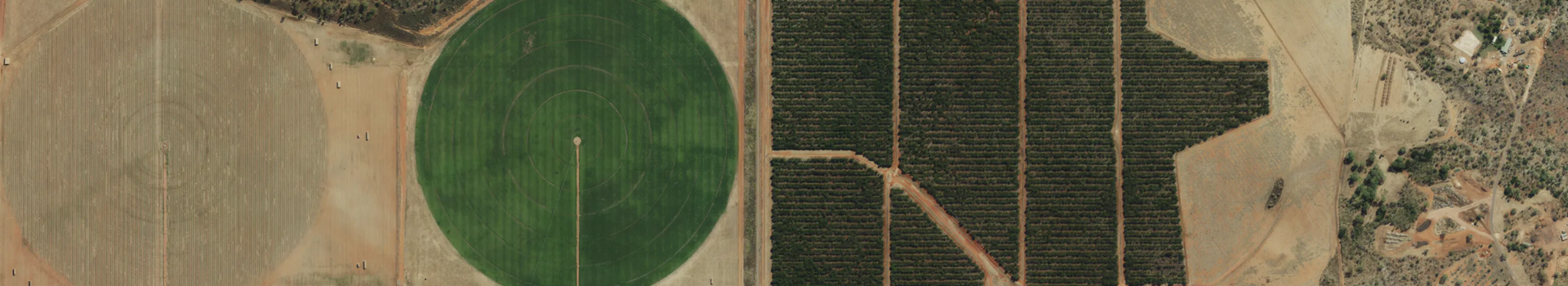
Aerometrex operates a fleet of LiDAR sensors that all have the ability to collect high-resolution aerial imagery simultaneously with the LiDAR data. Aerial imagery captured alongside LiDAR data typically has a pixel resolution of 7-10 cm, providing an unrivalled visual snapshot of the landscape as it is being flown over.
Image: High-resolution Aerial Imagery of pivot irrigation and sandalwood plantations west of Katherine captured by Aerometrex in 2022
If you're keen to discuss how airborne LiDAR can aid your land-planning strategies and maximise productivity, use the form below to reach out to our team.