The accuracy of Airborne LiDAR surveys is a topic that comes into discussions with end users daily. While the question, “How accurate is the data?”, may sound simple, it is highly nuanced. So, we decided to sit down with our LiDAR Product & Program Manager, Dr Sam Holt [SH] to understand it a bit more and put accuracy under the lens of a technical expert, but also learn what is important when working with customers who may have specific use cases and look at data accuracy from a different perspective.
Below are excerpts from our interview with Sam.
Q: Before we jump into details, why is accuracy such a critical topic when it comes to Airborne LiDAR data? Why discuss it?
[SH]: One of the key benefits of Airborne LiDAR as a remote sensing technology is its ability to generate highly accurate, holistic three-dimensional models of the environment at a large scale. As an active remote sensing technology, it can make these highly accurate measurements of not just what is directly visible from above but also quantitatively model the ground and infrastructure that is otherwise obscured by tree canopy by penetrating through it.
Despite its accuracy being a key advantage of Airborne LiDAR, how the accuracy is quantified and what uncertainties contribute to the final accuracy is often poorly understood and/or poorly communicated. Furthermore, the ‘accuracy’ of a survey may be communicated via a single statement, summarizing the absolute accuracy in the vertical and horizontal plane (as well as associated uncertainty). Such a simplified accuracy statement may not provide context for end-users not experienced with LiDAR technology.
A more detailed understanding of what factors contribute to the final accuracy of an Airborne LiDAR survey can be highly beneficial to end-users as it can empower them to understand what accuracy is required for a dataset to be fit for their purpose. Since increased accuracy specifications can come along with acquisition and processing costs, knowing what is fit for purpose is critical in assisting end-users to commission LiDAR surveys that are cost-effective and designed according to their requirements.
Q: Can you explain what factors contribute to the accuracy of an Airborne LiDAR survey?
[SH]: Numerous factors may cause positional uncertainties that affect the final accuracy of an Airborne LiDAR survey. Some of these factors are well understood and easily quantified, while others may be less clear and require retroactive investigation.
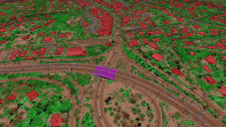
It is also important to note that in some applications, positional accuracy is not the only priority, but also the accuracy of the semantic classification that is applied to the LiDAR point cloud. In these cases, the end-user’s interpretation of the dataset accuracy may be wildly different to traditional accuracy definitions.
Key variables that contribute to the final accuracy of an Airborne LiDAR survey are:
Q: Can you help us break down and understand positional accuracy a bit more?
[SH] Within the Airborne LiDAR industry, there is no industry-wide standard on the terminology and associated definitions related to the accuracy of a LiDAR survey. So, I’ll explain it using terminology that is in line with the standards outlined by the American Society for Photogrammetry and Remote Sensing (ASPRS)[1].
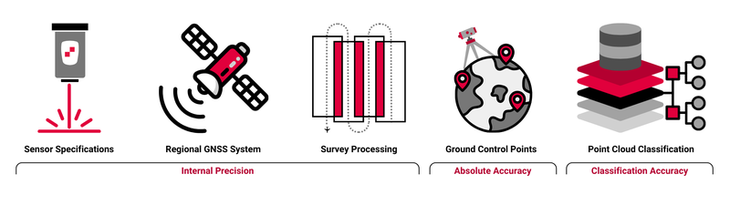
The variables I highlighted earlier are a subset of the common factors that combine to govern the overall Internal Precision and subsequent Absolute Accuracy of the LiDAR dataset.
Data Internal Precision is a measure of the variation of positional accuracy from point to point within a data set when evaluated across a levelled plane. It is sometimes also referred to as ‘Relative Accuracy’. Absolute Accuracy, on the other hand, is a measure that accounts for all systematic and random positional errors in a data set when it is referenced to a known and explicitly specified benchmark.
Q: So, why is Internal Precision important and what elements impact it?
[SH]: The Internal Precision of the LiDAR Point Cloud governs how confident a user can be when comparing points relative to each other within the point cloud, irrespective of the precise locations of these points on Earth. An example of this is quantifying the heights of trees across the landscape regardless of their location – this includes the comparison of the relative elevation of the top of the tree and the ground below.
The Internal Precision of a dataset is often assessed by quantifying common systematic uncertainties that can be caused by the technology used and how the point cloud is initially processed. Some of the most common contributors to Data Internal Precision are the LiDAR sensor’s specifications, the Regional GNSS system and the Survey Processing methodology.

Airborne LiDAR models the environment in 3D by measuring the distance between the LiDAR sensor and the point at which a laser pulse is reflected on the Earth’s surface. To do this effectively the precise location and orientation of the sensor within the aircraft must be measured constantly during a survey flight. This positioning is achieved by utilising regional positional networks. An example of such a network is the Australian Regional GNSS Network[3] consisting of approximately 100 Continuously Operating Reference Stations (CORS).
The number of stations available in the area, as well as their proximity to the survey can define how accurately the location of the sensor can be calculated. For example, utilising a single base station less than 20 km from the survey can provide positional accuracies of 2-5cm, whereas, utilising multiple base stations within 70 km of the survey area can provide a positional accuracy of 2-10cm.

All Airborne LiDAR sensors have a fundamental accuracy associated with each individual ranging measurement made which forms the LiDAR Point Cloud. These sensors are highly refined pieces of technology and can achieve very high accuracies at long ranges, with most industry standard sensors able to achieve centimetre accuracies.
The RIEGL VQ780 II-S LiDAR sensors currently operated by Aerometrex can achieve an accuracy of 2cm[2].
Airborne LiDAR surveys are collected in a series of individual swaths that are aligned to the flight plan of the survey. The flight is designed to include overlap between the swaths, as well as a ‘tying run’ that overlaps numerous swaths. This is done to not only ensure there are no gaps in the data but also to assist in merging individual swaths into a single coherent survey accurately. Depending on what method and software is used to align these swaths, in a process called strip alignment, the final accuracy of the alignment will vary.
Aerometrex utilises an in-house methodology, incorporating industry-leading software packages such as RiProcess and Bayesmap as well as rigorous QA/QC checks, to achieve strip alignment accuracies of ≤5cm.
Airborne LiDAR models the environment in 3D by measuring the distance between the LiDAR sensor and the point at which a laser pulse is reflected on the Earth’s surface. To do this effectively the precise location and orientation of the sensor within the aircraft must be measured constantly during a survey flight. This positioning is achieved by utilising regional positional networks. An example of such a network is the Australian Regional GNSS Network[3] consisting of approximately 100 Continuously Operating Reference Stations (CORS).
The number of stations available in the area, as well as their proximity to the survey can define how accurately the location of the sensor can be calculated. For example, utilising a single base station less than 20 km from the survey can provide positional accuracies of 2-5cm, whereas, utilising multiple base stations within 70 km of the survey area can provide a positional accuracy of 2-10cm.
All Airborne LiDAR sensors have a fundamental accuracy associated with each individual ranging measurement made which forms the LiDAR Point Cloud. These sensors are highly refined pieces of technology and can achieve very high accuracies at long ranges, with most industry standard sensors able to achieve centimetre accuracies.
The RIEGL VQ780 II-S LiDAR sensors currently operated by Aerometrex can achieve an accuracy of 2cm[2].
Airborne LiDAR surveys are collected in a series of individual swaths that are aligned to the flight plan of the survey. The flight is designed to include overlap between the swaths, as well as a ‘tying run’ that overlaps numerous swaths. This is done to not only ensure there are no gaps in the data but also to assist in merging individual swaths into a single coherent survey accurately. Depending on what method and software is used to align these swaths, in a process called strip alignment, the final accuracy of the alignment will vary.
Aerometrex utilises an in-house methodology, incorporating industry-leading software packages such as RiProcess and Bayesmap as well as rigorous QA/QC checks, to achieve strip alignment accuracies of ≤5cm.
Q: Are there any additional parameters that impact the overall absolute accuracy of LiDAR surveys?
[SH]: Absolute Accuracy is measured by comparing the dataset to a set of known, explicitly defined benchmarks. This comparison ascertains exactly how much the LiDAR dataset deviates from these known values, accounting for all positional uncertainties within the dataset, including those mentioned that contribute to the internal precision. It is a measure of how close to the real world the LiDAR point cloud model is and is communicated through specific vertical and horizontal accuracy statements, each with an associated confidence interval (CI).
Within the Airborne LiDAR industry, the benchmarks used are a series of survey Ground Control Points that are collected at several locations throughout the project area. These Ground Control Points can be used for two purposes, as checkpoints to validate the ‘out of the box’ Absolute Accuracy of a survey or be used to adjust the dataset to achieve an even higher Vertical Absolute Accuracy.
Aerometrex can achieve an ‘out of the box’ Vertical Absolute Accuracy of ±20cm at 95% CI (1.95 x RMSE) without adjustment, and an adjusted Vertical Absolute Accuracy of ±10cm at 68% CI (1.95 x RMSE) by utilising Ground Control for vertical adjustments. It must be noted that these values are minimum accuracies, and the final Vertical Absolute Accuracy may be higher.
The Horizontal Absolute Accuracy of a LiDAR survey is linked to the footprint of the laser beam, which in turn is governed by the sensor beam divergence and survey flying height. Each laser pulse illuminates a horizontal ellipsoidal area, known as the ‘footprint’, and every range measurement (return) will occur somewhere within that footprint. As such, the size of that footprint governs the Horizontal Absolute Accuracy. The Horizontal Absolute Accuracy of Aerometrex LiDAR surveys is ±30cm at 95% CI (1.73 x RMSE).

Q: You said that the end-user’s interpretation of the dataset accuracy may be different to traditional accuracy definitions. What do you mean?
[SH]: When it comes to end-use cases, many Airborne LiDAR applications require more than just positional accuracy in the dataset; they also need a highly accurate semantic classification of the point cloud.
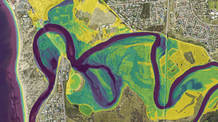
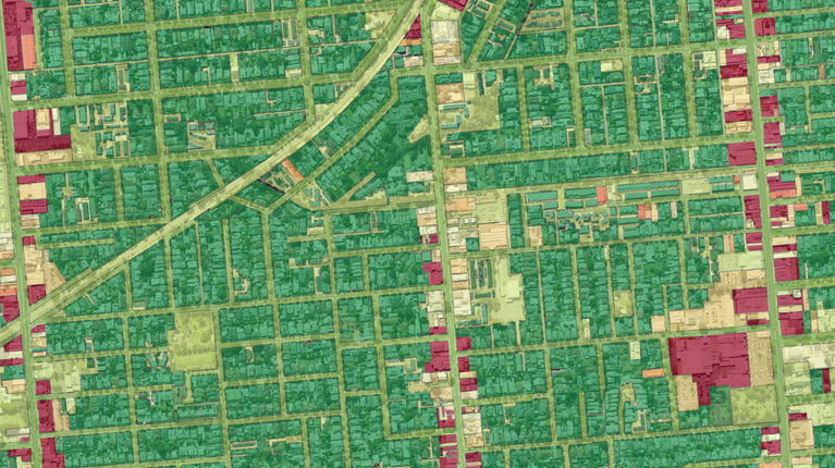
As part of the LiDAR classification process, every single point within the point cloud is assigned a class such as building, high vegetation, or noise (among others). The quality of this classification governs how accurately specific features can be extracted from the LiDAR point cloud and analysed. As an example, how accurately a Digital Terrain Model (DTM) describes the elevation of the ground relies on both an accurate ground classification to isolate the ground surface, as well as high vertical absolute accuracy to constrain the elevation of the ground.

Consider this scenario. A user commissions a LiDAR survey that when delivered, has very high positional accuracy, but the point cloud classification wasn’t done accurately or to the level required for a certain feature’s extraction. For that end-use, the customer will perceive the data as “low accuracy”. Thus, the overall accuracy of a dataset derived from a LiDAR survey should be viewed as a combination of the positional accuracy and the classification accuracy of the point cloud.
Aerometrex can provide a range of Classification Types, which are based on national standards set out by the Intergovernmental Committee on Surveying and Mapping (ICSM)[4]. These classification types are designed to deliver a LiDAR point cloud classification accuracy that is tailored towards the specific requirements of any given project.
Q: So, how accurate does an Airborne LiDAR survey need to be? Should users just go for the highest accuracy that fits their budget?
[SH]: The required positional accuracy and classification accuracy of any given Airborne LiDAR survey should be governed by how that dataset is going to be utilised, as well as the project budget.
One of the key ways in which a balance can be achieved between project budget and survey specification is knowing the accuracy that is required for end use and planning the survey accordingly. The right planning and consultation can reduce the cost of a survey in many ways, including removing Ground Control Survey costs and tailoring classification costs to the proposed end uses. Conversely, upfront investment to generate an informed survey design can also future-proof the acquired dataset against evolving priorities and analytical advancements by ensuring the accuracy of the Survey does not limit the useability of a dataset in the future.
Aerometrex is committed to collaborating closely with clients to ensure that every survey is designed specifically for their requirements, is fit for purpose and applicable to a wide range of end uses, all while future-proofing the data and maximising cost-efficiency.
References for key facts shared during the interview:
[1] ASPRS Positional Accuracy Standards for Digital Geospatial Data
[2] RIEGL VQ780 II-S LiDAR Fact Sheet
Contact our team using the form below and we'll reach out to discuss your requirements.