The Festival of Footy, AFL's inaugural "Gather Round” is being held in South Australia in 2023. 9 matches, 4 days, 3 venues and all 18 clubs descend on South Australia for a round of footy like never before. Football fans from around the country are set to flock to the state during the April school holidays. To join in this celebration, and share something unique with our readers, we thought we would get nerdy, and do what we do best – digitize the 3 venues through LiDAR (Light Detection and Ranging) and aerial imagery data created by us.
For the first time in the league's history, all nine matches in a single round of the AFL season will be played in one state during the "Gather Round", with affordable tickets making matches accessible for many. The event is slated to be one of the best on record in terms of hospitality and game bookings. At 53 days out, 80% of Adelaide’s 10,255 hotel rooms available were already booked out for the Saturday of the inaugural AFL Gather Round. Leading airline operators have added capacity to their flights to Adelaide for the event.
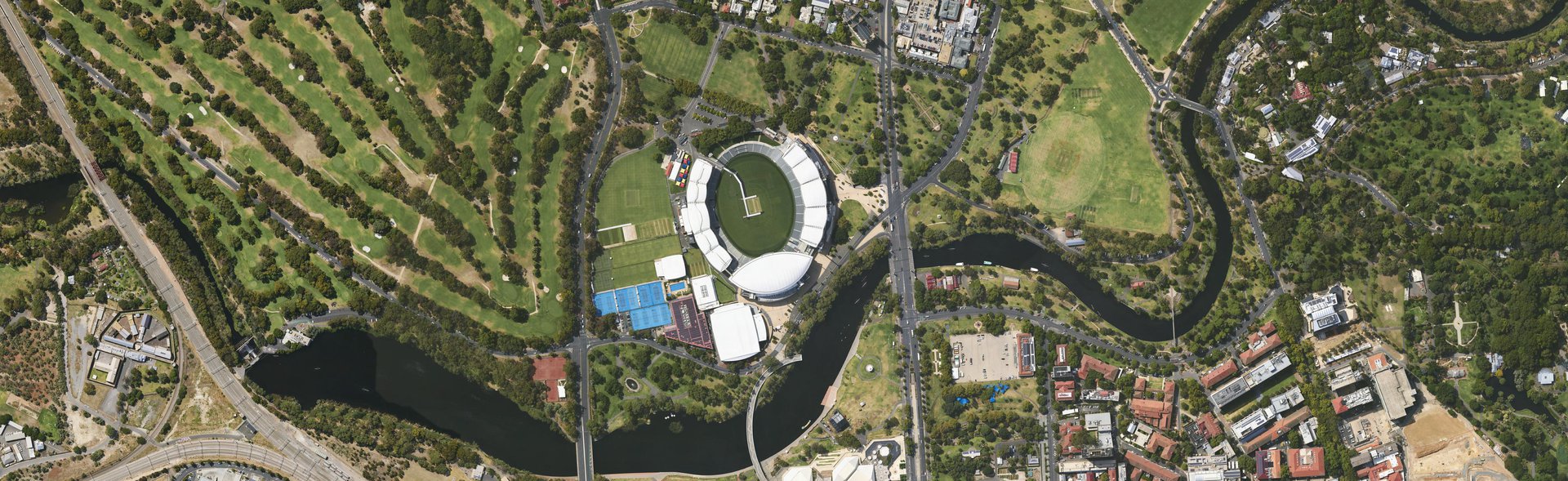
While Adelaide and surrounding regions shall be on showcase during the period, the key attractions of this sporting festival are the 3 venues for all the action. The Adelaide Oval will host six matches, with Norwood Oval playing home to two and Mount Barker one, providing an opportunity for interstate fans to get a taste of footy in the Adelaide Hills wine region.
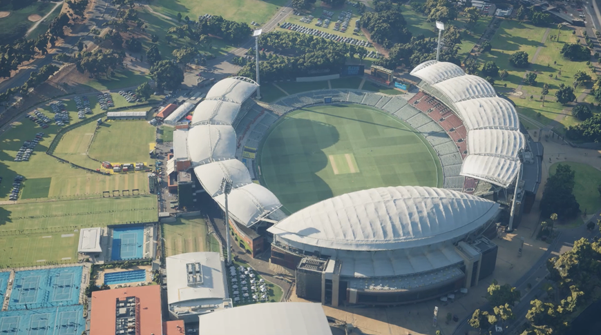
Image: Aerometrex 3D model of the Adelaide Oval visualised in Unreal Engine 5 with added lighting effects
At Aerometrex, we pride ourselves on providing solutions to critical infrastructure projects across sites such as these ovals, as well as to state & local government departments to support planning, community engagement, and promotional outreach via high-end visualisation. Geospatial data has proven critical from the pre-planning (site exploration), right through to the planning, development, and post-development stage of maintenance & monitoring.
Highly visual 2D and 3D data are excellent for community consultation on an ongoing basis, as well as for promotional outreach to attract investments and patrons to these kinds of festivals.
Geospatial data has proven critical from the pre-planning (site exploration), right through to the planning, development, and post-development stage of maintenance & monitoring. Not only that, highly visual 2D and 3D data are excellent for community consultation on an ongoing basis, as well as for promotional outreach to attract investments and patrons to these kinds of festivals.
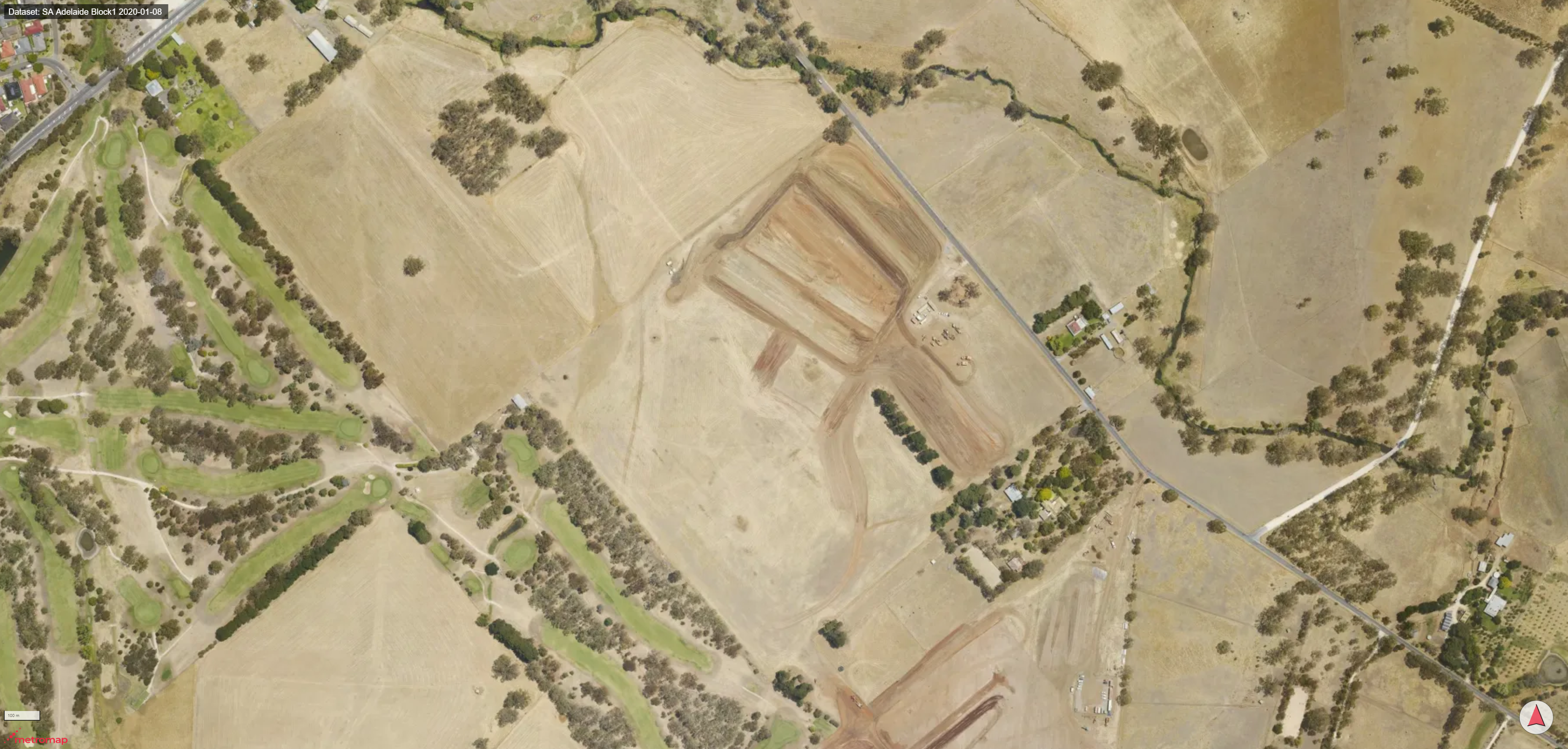
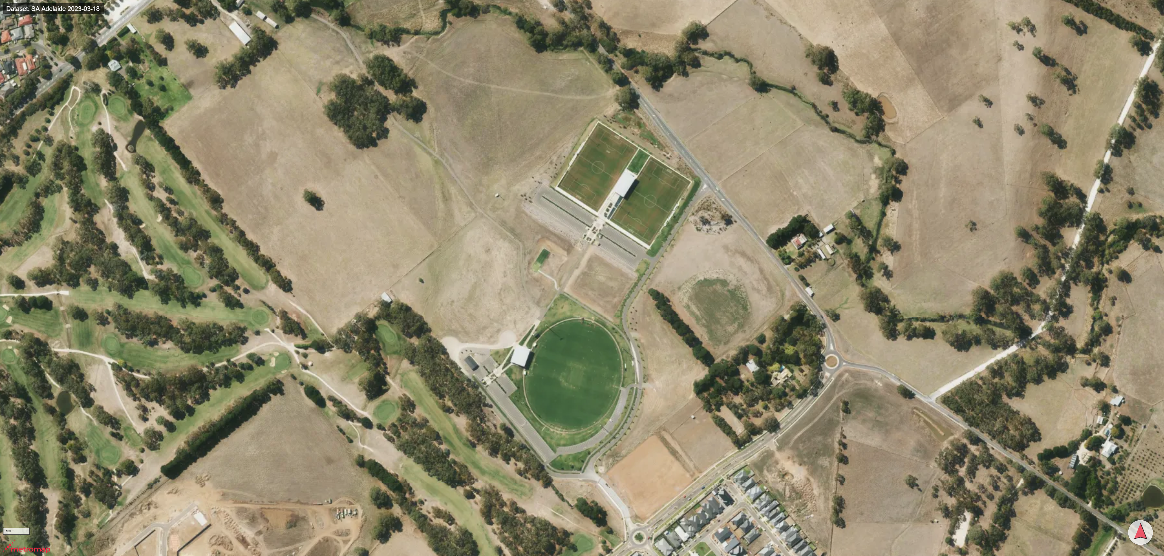
MetroMap's high resolution aerial imagery allows planners to visualise change across project sites such as the one above of "Summit Sports & Recreation Park" in Mount Barker.
Site Planning:
Geospatial data such as LiDAR can be used to generate a range of datasets highly valuable during the planning stage of projects. One example is topographical maps which can help developers analyse the terrain, slope and other site features that can determine the best location for key facilities. One such use case of site analysis is the identification of areas that may need additional grading or drainage within ovals.
LiDAR data can also be used to create high-detail maps of vegetation, including canopy cover & height maps. Details such as the density and distribution of vegetation can aid in preserving important habitats or planting new vegetation where necessary. This can help understand the impact of the project on the surrounding ecology and plan for any mitigation necessary. This site planning can be further supplemented by aerial imagery captured multiple times per year.
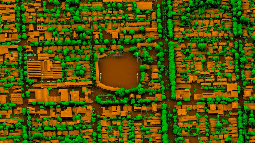
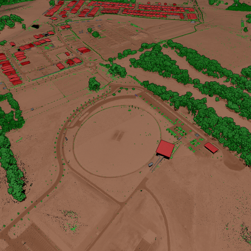
Image: Classified LiDAR point cloud of the Summit Sports & Recreation Park, Mt Barker
Design & Construction:
3D data, using LiDAR and photogrammetry, can be used to create 3D models of these sporting venues and surrounding areas. These models can be used to plan out designs and construction activity that works best with the site’s existing features, avoiding potential obstacles, and saving time & money. For example, spatial data can help developers plan for road and parking access to ovals and simulate traffic & crowds using 3D models and game engine technology.
Monitoring & Maintenance:
Post-project completion, both 2D imagery as well as 3D data from LiDAR and imagery, can prove very useful for ongoing site maintenance. By comparing data across time, developers can track changes in the site’s topography, vegetation, and other man-made features. For example, changes in slope or vegetation cover may indicate erosion or other issues that need to be addressed to ensure the long-term viability of the facility.
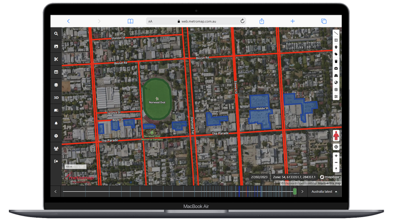
Image: MetroMap showing Norwood Oval and surrounding areas overlaid with planning features such as roads and parking.
Community Consultation and Visual Showcasing:
Communicating project analysis can sometimes prove difficult, especially for the public and other key stakeholders. Spatial data, due to its visual nature, can assist this process through 2D and 3D maps making the consultative process much easier and far more productive. With recent enhancements in game engine technology, which works well with spatial platforms & data, spatial experts can now showcase & promote planned & finished sites in stunning detail. These platforms can also act as tools for interactive maps during events such as the Gather Round, highlighting not only the venues, but surrounding hotels, restaurants, and other attractions.
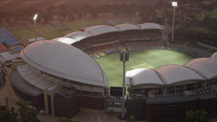
This short video clip showcases a 3D model of the oval visualised in the game engine with natural lighting as can be seen via the time lapse.
Interested in discussing your next critical infrastructure project with our team? Reach out to us using the form below and we'd love to see how our spatial data can help.