Specialists in 3D Reality Modelling

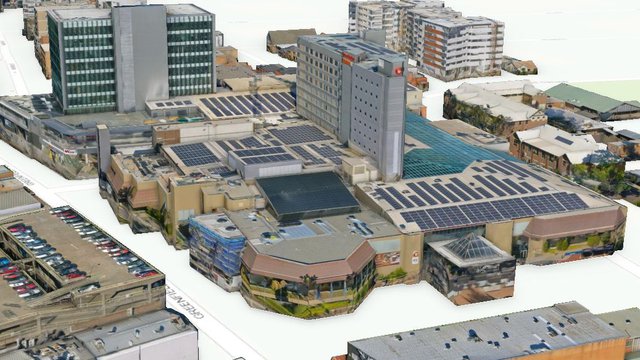
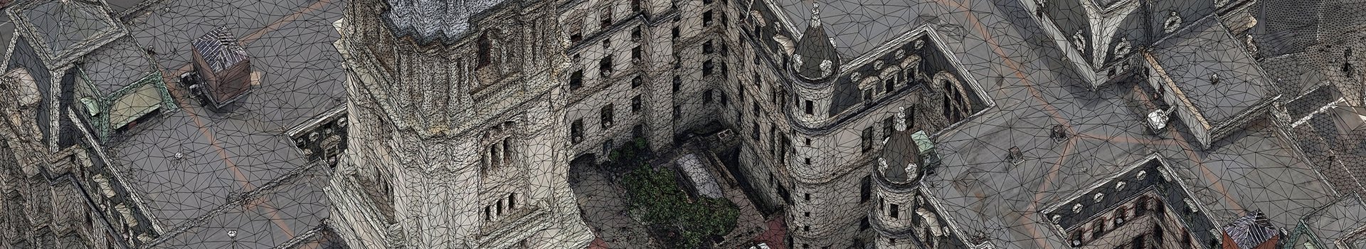
Aerometrex provides its global client base a range of sophisticated 3D reality modelling products and services based on advanced photogrammetric and visualisation techniques.

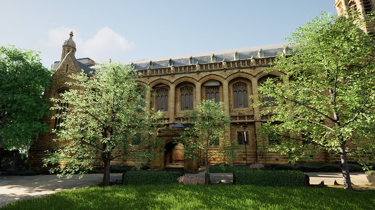
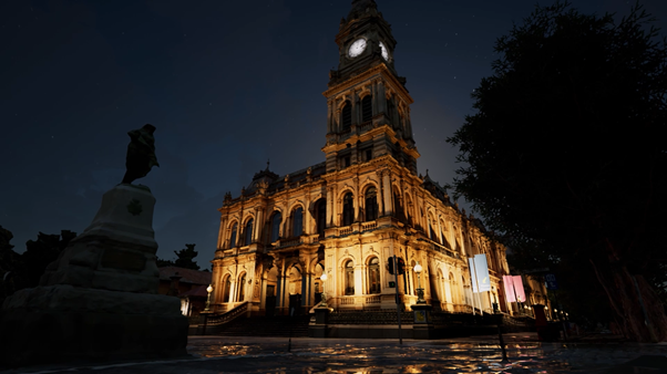
Our award-winning 3D modelling service provides an end-to-end solution: the whole workflow from flight planning and image acquisition to 3D processing and geo-registration is all done in-house. We have executed numerous projects that combine aerial acquisition from multiple platforms (aircraft, helicopters and UAVs as well as street-level imagery) and use the data generated to build a seamless 3D mesh model or ‘reality mesh’.

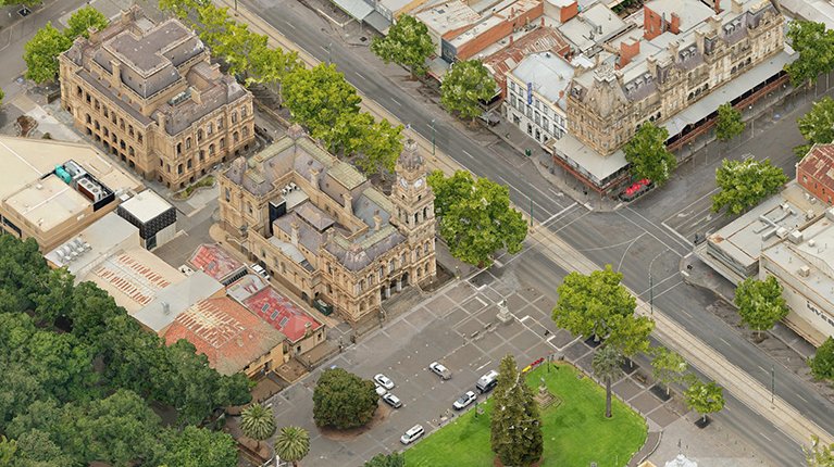
Our 3D data gives you access to high resolution 3D city mesh models that provide context to your projects, help develop and visualise scenarios as well as offer a comprehensive 3D base dataset for change monitoring.

Discover Our World-leading 3D Solutions

CITY MODELS

Check out 3D city models ready to buy as a whole, or clip the area you need via our MetroMap Store.

View City Models

CUSTOM PROJECTS

We work with you to tailor the best solution in terms of application, image resolution & accuracy.

Contact Our Team

Our clients choose us because of our...

High quality
The unprecedented complexity, high resolution detail and geospatial accuracy contained in Aerometrex 3D models, combined with the possibility to interact and extract real 3D information in both natural and built environments, provide a valuable resource for many industries.

Broad product range
From 3D mesh models to True Ortho imagery, and from Digital Surface Models (DSMs) to 3D Point Clouds, our range of products offer you a one-stop solution for all your 3D needs.

Customer-centric workflow
We work with clients to understand their requirements and tailor the best solution in terms of application-linked outputs, image resolution, accuracy, size and capture technique. We provide datasets in a range of CAD/GIS-ready 3D formats, packaged for online 3D platforms. We also provide value-added services to extract 3D information, perform 3D change analysis and integrate additional spatial data to the 3D city models.

Loading...

Request a 3D Sample Dataset

Disclaimer: Entering your e-mail address above, you agree to receive Aerometrex's e-mail communications, which you can change/withdraw from at any time. Privacy Policy

Our broad range of products & outputs

  • 3D mesh model in common 3D formats with Level of Detail and any additional geospatial data, 3D objects, etc. for integration into 3rd party rendering software such as Terragen, 3D Studio Max, Cinema 4D, TerraExplorer, Urban-Engine, Unity, etc.
  • True-ortho imagery, at resolutions up to 1 inch. True-ortho mosaic are vertical view imagery where all perspective distortions have been removed. This is particularly useful over central business districts
  • Digital Surface Models (DSMs)
  • 3D Point Clouds
  • Feature capture via vector mapping provides rich geospatial information necessary for the management of relational databases, especially for engineering projects. Most common features captured are buildings, roads, utilities, vegetation and rivers.
  • 3D Media - stills and animations
    • Complex 3D geo-information pictures for reports, presentations and posters
    • Fly-throughs for virtual tours, multimedia, web and corporate presentations
    • HD fly-throughs for publicity, advertising, TV and cinema
    • 3D Stereoscopic fly-throughs and animations for 3D TV and cinema
    • Interactive Virtual Reality fly-throughs for Oculus Rift
    • Augmented Reality applications for mobile devices
    • Simulated apartment views for high rise property marketing

Aerometrex 3D modelling has allowed the City of Karratha to capture in 3D, rapid changes in the City Centre via state government investment and allowed the city to give an impression of how the City Centre will look with planned new developments. The city has used this 3D modelling to promote the City Centre and attract funding to key City Centre projects.

Jerom Hurley, Manager Planning Services, City of Karratha

Professional and responsive. These guys are the real deal in their space. High quality work as well as great to work with.

Dr Ben Guy, CEO, Urban Circus

The 3D model has proven to be an invaluable tool in showcasing the master plan to councillors and the public. The “flythrough” is currently being shown as part of a display in our administration building reception area and is also on the Midland Oval Redevelopment page of the city’s website. This was the first time that the city has used Aerometrex and due to the excellent product and service provided, we will certainly consider using them again for future projects.

Colin Cameron, Executive Manager, City of Swan
 
Loading...

Contact Us

Resources

blog
3D Models and Virtual Tourism
Read more
blog
How Our Spatial Data Helped Build the Las Vegas Circuit in EA SPORTS™ F1® 23
Read more
blog
Capturing our cities with multiscale 3D mesh models
Read more

Subscribe to receive our latest announcements

X